Diamond Peak (Nevada)
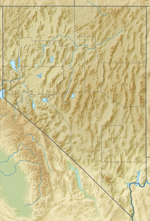
Diamond Peak is both the highest and most topographically prominent mountain in both the Diamond Mountains and Eureka County, in Nevada, United States. It ranks thirty-ninth among the most topographically prominent peaks in the state.[4] The peak is located on the border of Eureka County and White Pine County, about 12 miles northeast of the small town of Eureka,[1] between the south end of Diamond Valley and the central portion of Newark Valley. It is on public land administered by the Bureau of Land Management and thus has no access restrictions.
| Diamond Peak | |
|---|---|
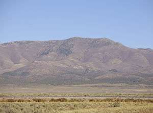 View of Diamond Peak from Eureka Airport | |
| Highest point | |
| Elevation | 10,631 ft (3,240 m) NAVD 88[1] |
| Prominence | 3,594 ft (1,095 m) [2] |
| Listing | Nevada County High Points 10th[2] |
| Coordinates | 39°35′06″N 115°49′07″W [1] |
| Geography | |
 Diamond Peak Nevada, U.S. | |
| Location | Eureka County and White Pine County, Nevada, U.S. |
| Parent range | Diamond Mountains |
| Topo map | USGS DIAMOND PEAK |
| Climbing | |
| Easiest route | From Newark Summit, north along a 4-wheel drive road and then the ridgeline, Class 2 scramble[3] |
- Not to be confused with Diamond Peak (ski area) near Lake Tahoe.
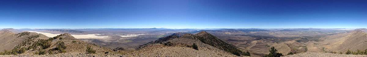
Summit panorama
References
- "DIAMOND PEAK". NGS data sheet. U.S. National Geodetic Survey. Retrieved 2014-10-06.
- "Diamond Peak, Nevada". Peakbagger.com. Retrieved 2014-10-06.
- "Diamond Peak". SummitPost.org. Retrieved 2014-11-12.
- "Nevada Peaks with 2000 feet of Prominence". Peakbagger.com. Retrieved 2014-10-23.
| Wikimedia Commons has media related to Diamond Peak (Nevada). |
This article is issued from Wikipedia. The text is licensed under Creative Commons - Attribution - Sharealike. Additional terms may apply for the media files.