Dhegihan History and Separation
The Dhegihan (Degihan) migration history and separation is the narrative of the long journey on foot by the North American Indians in the ancient Hoga tribe. During the migration from present-day Illinois/Kentucky and as far as Nebraska, they gradually split up in five groups. Each became an independent and historic tribe. They are the Omaha, Ponca, Kaw or Kansa, Osage and Quapaw.
| Languages | |
|---|---|
| Omaha-Ponca, Kaw-Osage, Quapaw | |
| Related ethnic groups | |
| Omaha, Ponca, Kaw, Osage, Quapaw |
The term "Dhegiha" refers to all five Indian tribes, since they speak a Dhegiha Siouan language. Besides having related languages, they share an oral tradition about a common origin from an ancestral tribe. The timing of the separation for these tribes and history prior to their existence as separate groups is the subject of some debate.
Before separation
_migration_story_according_to_oral_tradition._(Map_improved_2018).png)
The Quapaw, the Ponca, the Omaha, the Osage and the Kaw share a tradition, that back in time they were one people.[1]:37 [2]:6 [3]:14 [4]:281 [5]:232 The claim is supported by similar tribal organization with kinship groups (clans)[1]:38 and closely related languages, although some of the tribes were widely scattered in historic time.[3]:4 (The Ponca and Omaha settled in Nebraska, the Kaw in Kansas, the Osage in Missouri, while Arkansas became the homeland of the Quapaw.)
The people in the initial tribe called themselves the Hoga. It translates "leaders", meaning the preceding generations or "ancestors".[6]:331 They lived in villages of bark houses,[6]:332 made pottery, hunted and gathered and raised a small amount of corn.[6]:341 [7]:274 According to tribal oral history collected by James Owen Dorsey, Alice Cunningham Fletcher, Omaha Indian Francis La Flesche and other interested people, the early Dhegiha people resided in the valley of the lower Ohio River.[1]:72 [8]:211
This shared tradition is "generally rejected by professional archeologists".[2]:3 According to one theory, the tribes were longtime residents in the areas west of Mississippi River, where the whites encountered them.[5]:233
The migration
For some reason the tribe started on a journey down Ohio River prior to 1673.[2]:3 The migration may have been an answer to a breakdown of the old culture, climatic changes unfavorable for corn growing, epidemics and/or conflicts[7]:274 with Iroquoian and Algonquin Indians.[2]:5 and 7
While travelling, they lived in tents with the bottom of the cover secured with stones.[1]:72 Since the Hogas moved into new territory, the migration sometimes turned into an incursion.[2]:6
The first separation
Reaching the mouth of the Ohio, the Hoga began crossing Mississippi River in skin boats.[6]:332 The first separation occurred here. A part of the people either followed the Mississippi southward on the eastern shore[2]:6 or they drifted away with the current. They became the Quapaw, which means Downstream People.[6]:332 Those who went against the current of the river on the western shore became the Omaha or Upstream People.[1]:36
The Quapaw tribe may have been encountered by Hernando De Soto near the Mississippi in 1541. However, the available evidence is contradictory. (In 1938, the De Soto Commission concluded it was some Tunica Indians he encountered).[2]:8 Most likely, the Quapaw Indians had recently settled in the Lower Mississippi area, when the French expedition of Jacques Marquette and Louis Jolliet encountered them in 1673 along the Mississippi River near the mouth of the Arkansas.[2]:7–8 [9]:54
The Iowa Indians may have joined the Hogas and crossed the Mississippi with them.[1]:36 Other accounts state that the Iowa first met and joined the Indian migrants on the Lower Missouri[3]:15 or at a place on Des Moines River.[7]:275
Upstream
The main body of the Hoga followed the Mississippi north. They would in time separate and become the Osage, Kaw, Omaha and Ponca.
One account says the large group reached the mouth of Missouri River and followed it. For a time, they lived in the area of present-day Gasconade and Osage county, Missouri. Eventually, the people continued the journey and reached Osage River.[8]:212 Again, the group experienced a division. Disagreements over the division of animal sinews (used as threads and strings) caused this split.[10]:75 Some decided to explore the unknown country by way of Osage River and became respectively the Osage Indians and the Kaw or Kansa Indians.[3]:15 The Kaws may have gathered in a group, turned back, and followed the Missouri north to Kansas River, where they settled.[11]:6
Later, the Osage and the Quapaw in Arkansas turned enemies despite the common origin.[2]:32 Also the Omaha in Nebraska would in time be considered hostile by the Osage.[12]:118
The Omaha, walking away from the Osage/Kaw group in "an angry mood",[10]:75 kept travelling the southern banks of the Missouri.[3]:15 They crossed to the other shore at the mouth of Chariton River.[7]:275
Two different routes to the pipestone quarry in Minnesota are put forward. One account claims the people first followed Chariton River and later Des Moines River (green route on the map).[7]:275 The other version has the people travelling up the Missouri and apparently later the Big Sioux River (orange route on the map).[7]:275
A more different migration story has the people going up the Mississippi instead of the Missouri (yellow route on the map). Standing on the shore of Des Moines River, they made up their mind to follow this tributary to its source. From here, they moved on and found the catlinite quarry.[1]:36
A settlement near the Pipestone Quarry
The people found the red, workable catlinite in the area. They made the head to a sacred pipe of a big piece, later to become a part of the Ponca's tribal pipe. (The Ponca finished the long migration to the northeastern Nebraska before they finally made the stem to the pipe).[3]:17
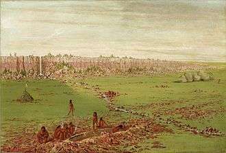
The people built a village near Big Sioux River, maybe at the Blood Run Site[13] in the northwestern Iowa. They came under attack from different groups of Sioux (Dakota) and abandoned the settlement after a major battle. The John K. Bear winter count of the lower Yanktonai Sioux says for the year 1685, "The Santee Dakota fought with the Omaha tribe". [14]:21 The many dead were buried in a wide mound near the village.[6]:332
In 1879, Yankton Sioux chief Strikes-the-Ree ascribed the war to conflicting claims to the pipestone quarry.[13]:359
On the move again
_and_Les_Maha_Nation_errente.png)
The people went south. Then, they seem to have headed north by following the Missouri upstream. They cut the wood to a sacred pole at a lake. Some Omahas, but not all, identified it as Lake Andes in South Dakota.[1]:73 This may have been sometime in the last quarter of the 17th century.[7]:276
Probably, the people then moved back to a place near the mouth of the Big Sioux. Living east of the Missouri, they harassed the Arikara Indians residing on the western shores.[1]:74 [7]:276 In time, the Omaha settled in a new village on the Big Sioux and made peace here with the Arikara (and the Cheyenne and the Oto as well). The Arikara women taught the Omaha to build earth lodges.[6]:332
The Big Sioux River village came under Indian attack. The Omaha, still followed by the Iowa, left the hostile area for good. All travel was yet on foot.[7]:276
Information given by the Frenchman Pierre-Charles Le Sueur "strongly suggest" the presence of Omahas somewhere on the Upper Big Sioux at least before the end of the 17th century. After 1714, French sources locate the Omaha Indians other places.[13]:380
The Ponca become a tribe
The Upstream People went north again and crossed the Missouri at the mouth of White River in South Dakota.[7]:276 Some evidence point to a temporary halt of the migration here.[15]:158 It seems, the Ponca clan of the Omaha became more independent in the new surroundings. While it explored the land westward, either as a clan or as a distinct tribe, the rest of the Omahas and the Iowa stayed in the White River belt.
The Ponca made it to the Black Hills.[3]:15 They returned to the Omaha and the Iowa and the three groups started a joint travel down the Missouri.
The Ponca settled near the city of Niobrara, Nebraska. The Omaha and the Iowa continued downstream, but remained in the future state of Nebraska.[3]:15 This final and lasting split may have taken place between 1714 and 1718.[7]:279
The Ponca would undertake long journeys from the villages to the Black Hills and even further west.[3]:18 On one trip to the Black Hills, they fought the "Padouca" - either Plains Apache or Comanche Indians. Later it came to a truce, and the Ponca received the first horses from the Padouca.[6]:333 [7]:276
The whites mention the Ponca tribe for the first time in 1785. A Spanish document gives the Ponca homeland accurately as the northeastern corner of Nebraska.[13]:366
After separation
See Omaha people, Kaw people, Osage nation, Ponca, and Quapaw
References
- Fletcher, Alice C. and F. La Flesche (1992): The Omaha Tribe. Lincoln and London.
- Baird, W. David (1980): The Quapaw Indians. A History of the Downstream People. Norman
- Howard, James H. (1965): The Ponca Tribe. Smithsonian Institution. Bureau of American Ethnology. Bulletin 195. Washington.
- La Flesche, Francis (1921): The Osage Tribe. Smithsonian Institution. 36th Annual Report of the Bureau of American Ethnology. Washington. Pp. 43-597.
- Vehik, Susan C.: "Dhegiha Origins and Plains Archaeology". Plains Anthropologist, Vol. 38 (No.v 1993), No. 146, pp. 231-252.
- Buffalohead, Eric: "Dhegihan History: A Personal Journey." Plains Anthropologist, Vol. 49 (Nov. 2004), No. 192, pp. 327-343.
- Ritter, Beth R. (2002): "Piecing Together the Ponca Past. Reconstructing Degiha Migrations to the Great Plains." Great Plains Quarterly, Vol. 22 (Fall 2002), No. 4, pp. 271-284.
- Dorsey, J. Owen (1884): Omaha Sociology. Smithsonian Institution. 3rd Annual Report of the Bureau of Ethnology, 1881-'82. Washington.
- House, John H.(2013): "Native American Material Culture from the Wallace Bottom Site, Southeastern Arkansas." Southeastern Archaeology, Vol. 32 (Summer 2013), No. 1, pp. 54-69.
- La Flesche, Francis (2010): Traditions of the Osage: Stories Collected and Translated by Francis La Flesche. Mexico Press.
- Wedel, Waldo R. (1946): "The Kansa Indians". Transactions of the Kansas Academy of Science. Vo. 49 (Jun. 1946), No. 1, pp. 1-35.
- Scherer, Johanna Cohan: "The 1852 Omaha Indian Delegation Daguerreotypes. A Preponderance of Evidence." Nebraska History. Vol. 78 (Fall 1997), No. 3, pp. 116-121.
- Thiessen, Thomas D. (2004): "Blood Run Site". Plains Anthropologist, Vol. 49 (Nov. 2004), No. 192, pp. 355-380.
- Howard, James H.: "Yanktonai Ethnohistory and the John K. Bear Winter Count". Plains Anthropologist. Vol. 21 (Aug. 1976), No. 73. Memoir 11, part 2, pp. 1-78.
- Johnson, Craig M. (2007): A Chronology of Middle Missouri Plains Village Sites. Smithsonian Contributions to Anthropology. Number 47. Washington.