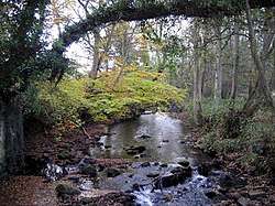
Devil's Water
Devil's Water is a river in Northumberland, England. A tributary of the River Tyne, it joins that river from the south, near the village of Dilston about 1 mile (1.6 km) south-west of Corbridge. It is formed from the waters of several smaller burns and sikes between Embley and Hackford some 5 miles (8 km) south of Hexham.[1][2][3]
| Devil's Water | |
|---|---|
 Devil's Water | |
 Location within Northumberland | |
| Location | |
| Country | United Kingdom |
| County | Northumberland |
| Physical characteristics | |
| Mouth | |
⁃ coordinates | 54.9746°N 2.0395°W |
| Length | 26.3 km (16.3 mi) |
Its tributaries include Rowley Burn and West Dipton Burn.[2]
Devil's Water is of historical interest, figuring in the Battle of Hexham.
Etymology
The name Devil's Water may share an etymology with the various rivers named Douglas in Northern England and Scotland such as the Douglas Water and River Douglas.[4] The name is derived from the Brittonic elements dūβ-, meaning "black",[4] and *glẹ:ss, "stream, rivulet, watercourse" (Welsh du-glais).[4]
References
- "Devil's Water". The UK Rivers Guidebook. 2000-01-01. Retrieved 14 April 2016.
- "Devils Water from Rowley Burn to Tyne". Catchment Data Explorer. Environment Agency. Retrieved 14 April 2016.
- "Devils Water from Source to Rowley Burn". Catchment Data Explorer. Environment Agency. Retrieved 14 April 2016.
- James, Alan. "A Guide to the Place-Name Evidence" (PDF). SPNS - The Brittonic Language in the Old North. Archived from the original (PDF) on 13 August 2017. Retrieved 25 November 2018.