Cuyón, Aibonito, Puerto Rico
Cuyón is a barrio in the municipality of Aibonito, Puerto Rico. Its population in 2010 was 977.[3][4][5]
Cuyón | |
|---|---|
Barrio | |
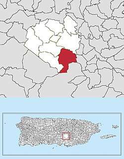 Location of Cuyón within Aibonito in Puerto Rico | |
| Coordinates: 18°05′48″N 66°14′27″W[1] | |
| Commonwealth | |
| Municipality | |
| Area | |
| • Total | 4.10 sq mi (10.6 km2) |
| • Land | 4.10 sq mi (10.6 km2) |
| • Water | 0.00 sq mi (0.0 km2) |
| Elevation | 1,860 ft (570 m) |
| Population (2010) | |
| • Total | 977 |
| • Density | 238.3/sq mi (92.0/km2) |
| Source: 2010 Census | |
| Time zone | UTC−4 (AST) |
The Cuyón River runs through this barrio and through Coamo.
History
The United States took control of Puerto Rico from Spain in the aftermath of the Spanish-American War under the terms of the Treaty of Paris of 1898. In 1899, the United States conducted its first census of Puerto Rico finding that the population of Cuyón barrio was 1,027.[6]
As an electoral unit
In 2016, the following areas, sectors and neighborhoods were included in the Cuyón barrio electoral unit: Cuyón I y II, Sector Vertero, Sector Jagüeyes, Carretera 162, Sector El Fresar, Sector Rincón, Sector Ratones, Carretera 716, Sector Gallardo Abajo, and Sector Boquerón with their voting location in nearby Pasto barrio.[7]
See also
References
- "US Gazetteer 2019". US Census. US Government.
- U.S. Geological Survey Geographic Names Information System: Cuyón barrio
- Picó, Rafael; Buitrago de Santiago, Zayda; Berrios, Hector H. Nueva geografía de Puerto Rico: física, económica, y social, por Rafael Picó. Con la colaboración de Zayda Buitrago de Santiago y Héctor H. Berrios. San Juan Editorial Universitaria, Universidad de Puerto Rico,1969.
- Gwillim Law (20 May 2015). Administrative Subdivisions of Countries: A Comprehensive World Reference, 1900 through 1998. McFarland. p. 300. ISBN 978-1-4766-0447-3. Retrieved 25 December 2018.
- Puerto Rico:2010:population and housing unit counts.pdf (PDF). U.S. Dept. of Commerce, Economics and Statistics Administration, U.S. Census Bureau. 2010.
- Joseph Prentiss Sanger; Henry Gannett; Walter Francis Willcox (1900). Informe sobre el censo de Puerto Rico, 1899, United States. War Dept. Porto Rico Census Office (in Spanish). Imprenta del gobierno. p. 164.
- "Voting Centers for 2016 Elections" (PDF). Comisión Estatal de Elecciones (in Spanish). Estado Libre Asociado de Puerto Rico. Retrieved 2 July 2019.