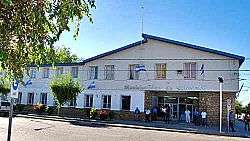
Cutral Có
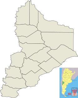
Cutral Có is a city in the Confluencia Department of Neuquén Province in Argentina. It is part of the statistical area formed with neighboring Plaza Huincul.
Cutral Có | |
|---|---|
 | |
 Coat of arms | |
 Cutral Có  Cutral Có | |
| Coordinates: 38°56′S 69°14′W | |
| Country | |
| Province | |
| Department | Confluencia |
| Founded | October 22, 1933 |
| Government | |
| • Mayor | Tomás Eduardo Benítez (UCR) |
| Area | |
| • Total | 81 km2 (31 sq mi) |
| Elevation | 541 m (1,775 ft) |
| Population (2010 census) | |
| • Total | 35,465 |
| • Density | 440/km2 (1,100/sq mi) |
| Demonym(s) | cutralcoense |
| Time zone | UTC-3 (ART) |
| CPA base | Q8322 |
| Dialing code | +54 0299 |
| Climate | BWk |
| Website | Official website |
The settlement is located in the desert, it was founded in 1933 after the discovery of oil. The majority of the economy is based on the petrochemical industry. Cutral-Có is home to several multinational corporations such as Repsol-YPF and Petrobras.
Following the 1992 privatization of YPF, thousands of people lost their jobs in the city's important industrial action.
There are plans to transport water from the Río Neuquén in order to introduce agriculture to the region.
The city used to have its own airport.
Climate
| Climate data for Cutral Có | |||||||||||||
|---|---|---|---|---|---|---|---|---|---|---|---|---|---|
| Month | Jan | Feb | Mar | Apr | May | Jun | Jul | Aug | Sep | Oct | Nov | Dec | Year |
| Record high °C (°F) | 39.4 (102.9) |
38.3 (100.9) |
35.5 (95.9) |
32.2 (90.0) |
27.8 (82.0) |
26.0 (78.8) |
25.1 (77.2) |
26.2 (79.2) |
28.3 (82.9) |
34.1 (93.4) |
36.2 (97.2) |
39.1 (102.4) |
39.4 (102.9) |
| Average high °C (°F) | 29.8 (85.6) |
29.3 (84.7) |
25.9 (78.6) |
20.2 (68.4) |
15.6 (60.1) |
11.7 (53.1) |
11.8 (53.2) |
14.3 (57.7) |
16.4 (61.5) |
20.7 (69.3) |
25.1 (77.2) |
27.6 (81.7) |
20.7 (69.3) |
| Daily mean °C (°F) | 21.0 (69.8) |
20.4 (68.7) |
17.5 (63.5) |
12.9 (55.2) |
9.1 (48.4) |
5.6 (42.1) |
5.6 (42.1) |
7.5 (45.5) |
9.2 (48.6) |
13.1 (55.6) |
17.4 (63.3) |
19.8 (67.6) |
13.3 (55.9) |
| Average low °C (°F) | 14.0 (57.2) |
13.1 (55.6) |
10.5 (50.9) |
6.9 (44.4) |
3.6 (38.5) |
0.8 (33.4) |
0.4 (32.7) |
1.5 (34.7) |
3.1 (37.6) |
6.2 (43.2) |
10.1 (50.2) |
12.2 (54.0) |
6.9 (44.4) |
| Record low °C (°F) | 5.0 (41.0) |
4.1 (39.4) |
−4.0 (24.8) |
−2.3 (27.9) |
−5.6 (21.9) |
−10.2 (13.6) |
−9.6 (14.7) |
−7.0 (19.4) |
−7.5 (18.5) |
−2.1 (28.2) |
1.8 (35.2) |
−0.7 (30.7) |
−10.2 (13.6) |
| Average precipitation mm (inches) | 9.5 (0.37) |
10.5 (0.41) |
11.5 (0.45) |
19.0 (0.75) |
14.5 (0.57) |
18.0 (0.71) |
13.0 (0.51) |
8.0 (0.31) |
16.5 (0.65) |
27.5 (1.08) |
14.5 (0.57) |
15.0 (0.59) |
177.5 (6.99) |
| Average relative humidity (%) | 31.5 | 36.5 | 42.0 | 49.5 | 59.5 | 66.0 | 64.5 | 54.5 | 49.5 | 43.5 | 37.5 | 34.0 | 47.4 |
| Source: Secretaria de Mineria[1] | |||||||||||||
References
- "Provincia de Neuquén - Clima Y Meteorologia: Datos Meteorologicos Y Pluviometicos" (in Spanish). Secretaria de Mineria de la Nacion (Argentina). Archived from the original on February 20, 2015. Retrieved July 13, 2015.
External links
- (in Spanish) Federal website
- (in Spanish) Municipal website
This article is issued from Wikipedia. The text is licensed under Creative Commons - Attribution - Sharealike. Additional terms may apply for the media files.