Creelsboro Natural Bridge
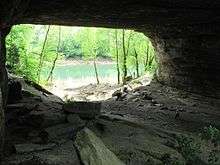
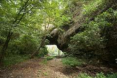
Creelsboro Natural Bridge (more commonly referred to as Rock House or the Rockhouse) is a natural bridge in southwestern Russell County, Kentucky, United States. It is located near the community of Creelsboro, approximately 7 miles (11 km) downstream from Wolf Creek Dam, which impounds Lake Cumberland. The Rockhouse is classified as a meander natural bridge because it was created by river erosion of a cliff on the outer side of a sharp meander in the river. Jim Creek flows through it before merging into the Cumberland River. With a span of 104 feet (32 m), it is the seventh largest natural bridge in the United States.
| Creelsboro Natural Bridge | |
|---|---|
 | |
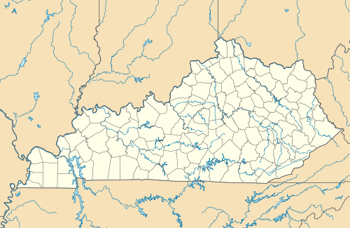 Map of Kentucky | |
| Location | Russell County, Kentucky |
| Nearest city | Creelsboro |
| Coordinates | 36°53′05.97″N 85°14′11.13″W |
| Designated | 1987 |
History
The Creelsboro Natural Bridge consists of Upper Ordovician Period silty dolomite of the Cumberland Formation. Unlike most natural bridges it is made of dolomite rather than sandstone. First discovered in 1770 by a group of hunters, Rockhouse is a popular site for camping. It was designated a National Natural Landmark by the U.S. National Park Service in 1987.[1] It remains privately owned but is accessible by a short walk from KY 379. Immediately across the river in Clinton County is the private Rockhouse Trace.
See also
References
- "Creelsboro Natural Bridge". nps.gov. National Park Service.
- Creelsboro Natural Bridge
- Rockhouse Bottom
- Rockhouse Pictures
- Kentucky Geological Survey
- Kentucky Geological Survey GQMAPS, S36