County of Nares

The county of Nares is a cadastral division of Queensland which contains the city of Cairns, Innisfail and most of the Atherton Tableland. It was named after George Nares (1831–1915), a naval officer and commander of HMS Salamander.[1] Cairns is mentioned as being in the county of Nares in the 1911 Britannica.[2] It is bounded by the Daintree River in the north.[3]

Nares
Queensland
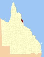
Location within Queensland
Lands administrative divisions around Nares:
Chelmsford Solander Pacific Ocean
Dagmar Nares Pacific Ocean
Hodgkinson Cardwell Pacific Ocean

Parishes

Nares is subdivided into parishes, listed as follows:

ParishLGACoordinatesTowns
BarronTablelands17°15′S 145°29′EAtherton, Tolga
Bartle FrereTablelands17°25′S 145°45′E
Bellenden KerCairns17°20′S 145°53′EBabinda, Bellenden Ker, Miriwinni
CairnsCairns16°53′S 145°40′ECairns, Kuranda
DanbullaTablelands17°07′S 145°36′E
DindenMareeba17°00′S 145°34′E
DirranTablelands17°30′S 145°37′ETarzali, Millaa Millaa
DulanbanCairns16°40′S 145°33′E
East BarronTablelands17°19′S 145°33′EYungaburra
FormartineMareeba16°52′S 145°29′E
GadgarraTablelands17°15′S 145°44′E
GladyCassowary Coast17°28′S 145°56′EFlying Fish Point
GraftonCairns17°05′S 145°44′EEdmonton, Gordonvale
HullCassowary Coast17°47′S 146°00′ESilkwood, South Mission Beach, El Arish
JapoonCassowary Coast17°44′S 145°55′EJapoon
JohnstoneCassowary Coast17°36′S 145°55′EInnisfail, South Johnstone
JordanCassowary Coast17°39′S 145°45′E
MalandaTablelands17°22′S 145°37′EMalanda
MonamonaMareeba16°46′S 145°30′E
MourilyanCassowary Coast17°37′S 146°03′EMourilyan, parts of Innisfail
PalmerstonCassowary Coast17°34′S 145°45′E
RussellCairns17°19′S 145°59′EBramston Beach
SmithfieldTablelands16°46′S 145°38′ENorthern Beaches
SophiaCairns17°07′S 145°52′EAloomba
TinarooMareeba17°04′S 145°25′EMareeba, Walkamin
TrinityCairns16°58′S 145°49′EYarrabah

References

  1. "Nares - county (entry 23870)". Queensland Place Names. Queensland Government. Retrieved 21 June 2017.
  2. Chisholm, Hugh, ed. (1911). "Cairns" . Encyclopædia Britannica. 4 (11th ed.). Cambridge University Press. p. 953.
  3. Cook District, County of Nares Maps - P9 Series Archived 2011-07-22 at the Wayback Machine at Queensland Archives.

This article is issued from Wikipedia. The text is licensed under Creative Commons - Attribution - Sharealike. Additional terms may apply for the media files.