County of Dawson
The County of Dawson is a county (a cadastral division) in Queensland, Australia, located in the Shire of Banana in Central Queensland. The county was officially named and bounded by the Governor in Council on 7 March 1901 under the Land Act 1897.[1][2]
| Dawson Queensland | |||||||||||||||
|---|---|---|---|---|---|---|---|---|---|---|---|---|---|---|---|
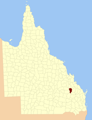 Location within Queensland | |||||||||||||||
| |||||||||||||||
Parishes
Dawson is divided into parishes, as listed below:
| Parish | LGA | Coordinates | Towns |
|---|---|---|---|
| Belmont | Banana | 24°47′S 150°21′E | |
| Blackman | Banana | 25°21′S 150°12′E | |
| Camboon | Banana | 25°05′S 150°30′E | Camboon |
| Colombo | Banana | 24°51′S 150°30′E | |
| Coteeda | Banana | 25°09′S 150°12′E | |
| Cracow | Banana | 25°24′S 150°19′E | Cracow |
| Dresden | Banana | 25°16′S 150°22′E | |
| Kianga | Banana | 24°43′S 150°07′E | |
| Mungungal | Banana | 25°08′S 150°21′E | |
| Okangal | Banana | 25°01′S 150°19′E | |
| Tarramba | Banana | 24°39′S 150°14′E | |
| Walloon | Banana | 24°57′S 150°08′E | Theodore |
| Woolthorpe | Banana | 24°51′S 150°05′E | |
| Woolton | Banana | 24°54′S 150°20′E |
References
- "Dawson (entry 9450)". Queensland Place Names. Queensland Government. Retrieved 8 September 2015.
- Leichhardt District, County of Dawson Maps - G8 Series at Queensland Archives.
External links
This article is issued from Wikipedia. The text is licensed under Creative Commons - Attribution - Sharealike. Additional terms may apply for the media files.