Coatepeque Caldera
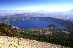
Caldera De Coatepeque (Nahuatl cōātepēc, "at the snake hill") is a volcanic caldera in El Salvador in Central America. The caldera was formed during a series of minor rhyolitic explosive eruptions between about 72,000 and 57,000 years ago. Since then, basaltic cinder cones and lava flows formed near the west edge of the caldera, and six rhyodacitic lava domes have formed. The youngest dome, Cerro Pacho, formed after 8000 BC.
| Lago de Coatepeque | |
|---|---|
 | |
| Coordinates | 13.87°N 89.55°W |
| Type | crater lake |
| Basin countries | El Salvador |
| Surface area | 26 km2 (10 sq mi) |
| Islands | Teopan |
| Coatepeque Caldera aka Coatepeque Lake (Lago De Coatepeque) | |
|---|---|
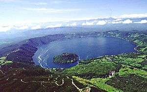 Aerial view of Lago Coatepeque | |
| Highest point | |
| Elevation | 746 m (2,448 ft) |
| Coordinates | 13.87°N 89.55°W |
| Geography | |
| Location | El Salvador |
| Geology | |
| Mountain type | Caldera |
| Last eruption | Unknown |
Lake Coatepeque
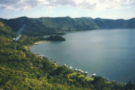
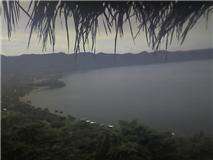
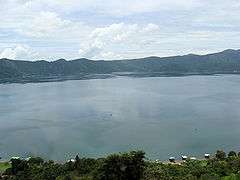
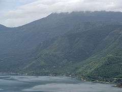
Lake Coatepeque (Lago de Coatepeque) is a large crater lake in the east part of the Coatepeque Caldera. It is in Coatepeque municipality, Santa Ana, El Salvador. There are hot springs near the lake margins. At 26 square kilometres (10 sq mi), it is one of the largest lakes in El Salvador. In the lake is the island of Teopan, which was a Mayan site of some importance.
See also
External links