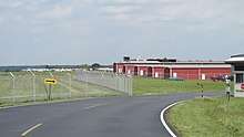
Clermont County Airport
Clermont County Airport (FAA LID: I69) is a public use airport located two nautical miles (4 km) west of the central business district of Batavia, a village in Clermont County, Ohio, United States. It is owned by the Clermont County Commissioners.[1]
Clermont County Airport Sporty's Airport | |||||||||||
|---|---|---|---|---|---|---|---|---|---|---|---|
 | |||||||||||
| Summary | |||||||||||
| Airport type | Public | ||||||||||
| Owner/Operator | Clermont County Commissioners | ||||||||||
| Serves | Clermont County, Ohio | ||||||||||
| Location | Batavia, Ohio | ||||||||||
| Elevation AMSL | 844 ft / 257 m | ||||||||||
| Coordinates | 39°04′42″N 084°12′37″W | ||||||||||
| Website | www.flyeca.com | ||||||||||
| Map | |||||||||||
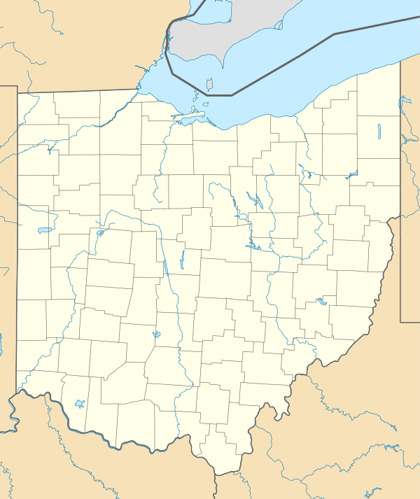 I69 Location of airport in Ohio/United States  I69 I69 (the United States) | |||||||||||
| Runways | |||||||||||
| |||||||||||
| Statistics (2007) | |||||||||||
| |||||||||||
It is also known as Sporty's Airport. The fixed-base operator is Eastern Cincinnati Aviation. The Tri-State Warbird Museum is located on the west side of the airport. The 279th Composite Squadron of the Civil Air patrol is headquartered at the airport as well.[2]
History
The airport was managed by the husband and wife team of Randolph and Rosalie Burchett from the early 1970s through 1986.[3]
In early 2011 the owner of the airport's fixed base operator proposed extending the airport's runway.[4] In mid-2013 discussions were ongoing regarding the possibility of extending the runway.[5] By early 2014 the county was attempting to buy the land necessary for the runway extension.[6] The Clermont County Transportation Improvement District board voted to approve the runway extension on 15 January 2016.[7] In early 2017 the runway extension plan needed approval from the Federal Aviation Administration.[8] However, by February 2018 the runway extension had been cancelled.[9]
Facilities and aircraft
Clermont County Airport covers an area of 60 acres (24 ha) at an elevation of 844 feet (257 m) above mean sea level. It has one runway designated 4/22 with a 3,568 x 75 ft (1,088 x 23 m) asphalt surface.[1]
The airport is served by four instrument approaches, including an RNAV (GPS) approach to both runway 4 and 22.[10]
For the 12-month period ending December 19, 2007, the airport had 30,650 aircraft operations, an average of 83 per day: 98% general aviation, 2% air taxi and <1% military. At that time there were 120 aircraft based at this airport: 88% single-engine, 7% multi-engine, 4% helicopter, 1% jet and 1% glider.[1]
Accidents and incidents
- On 15 August 1998, a Beechcraft Bonanza crashed near the airport after an aborted approach, killing the pilot.[11][12]
- On 11 April 2005, a Cessna 152 crashed near Mount Orab, Ohio after taking off from the airport, killing an instructor and student.[13][14]
- On 12 April 2014, an Avid Flyer crashed on a golf course in Withamsville, Ohio after taking off from the airport.[15][16]
- On 5 July 2015, an Aviat Husky crashed in Pierce Township after taking off from the airport.[17][18]
References
- FAA Airport Master Record for I69 (Form 5010 PDF), effective 2008-04-10
- Ryan, Kevin. "Welcome to the Home of the Flying Mustangs!". Clermont County Composite Squadron. Clermont County Composite Squadron, Civil Air Patrol. Retrieved 21 July 2017.
- Roller, Brett A. (9 December 2010). "Local aviator Burchett Hager got county airport off the ground". The Clermont Sun. Retrieved 10 January 2020.
- Roller, Brett A. (3 February 2011). "Airport runway extension proposed". The Clermont Sun. Clermont Sun Publishing Company. Retrieved 19 March 2017.
- Rover, Kristin (13 June 2013). "Officials discussing airport runway extension". The Clermont Sun. Clermont Sun Publishing Company. Retrieved 19 March 2017.
- Rover, Kristin (4 April 2014). "County may receive funds for airport runway extension". The Clermont Sun. Clermont Sun Publishing Company. Retrieved 19 March 2017.
- Alley, Megan (21 January 2016). "Board approves runway expansion". The Clermont Sun. Clermont Sun Publishing Company. Retrieved 19 March 2017.
- "Minutes of the Annual Meeting" (PDF). Clermont County Transportation Improvement District. 13 January 2017. Retrieved 19 March 2017.
- Alley, Megan (1 February 2018). "County could exchange runway extension money for new sheriff's training center". The Clermont Sun. Champion Media. Retrieved 14 March 2018.
- "I69". AOPA Airports.
- Sanchez, Robert; McCain, Marie (August 16, 1998). "Plane crash kills surgeon". The Cincinnati Enquirer. Gannett. Retrieved 30 March 2015.
- "NTSB Identification: IAD98FA094". National Transportation Safety Board. Retrieved 19 March 2017.
- Story, Justin (12 April 2005). "Investigators begin to unravel story behind Mount Orab plane crash". The Ledger Independent. Ledger Independent. Archived from the original on 19 March 2017. Retrieved 19 March 2017.
- "NTSB Identification: NYC05FA069". National Transportation Safety Board. Retrieved 19 March 2017.
- Kiefaber, Adam (12 April 2014). "Plane makes emergency landing on golf course". Cincinnati Enquirer. Retrieved 14 March 2018.
- "ASN Wikibase Occurrence # 165433". Aviation Safety Network. Aviation Safety Network. Retrieved 14 March 2018.
- Doran, Kelly (9 July 2015). "Plane crashes in Pierce Township". The Clermont Sun. Champion Media. Retrieved 26 March 2018.
- "National Transportation Safety Board Aviation Accident Preliminary Report [CEN15LA303]". National Transportation Safety Board. Retrieved 26 March 2018.
External links
- Eastern Cincinnati Aviation
- Sporty's Pilot Shop
- Clermont County Airport on AOPA
- Clermont County Composite Squadron – Civil Air Patrol
- Tri-State Warbird Museum
- Resources for this airport:
- FAA airport information for I69
- AirNav airport information for I69
- FlightAware airport information and live flight tracker
- SkyVector aeronautical chart for I69