Chuya
The Chuya (Russian: Чуя) is a river in the Altai Republic in Russia, a right tributary of the Katun (Ob's basin). The Chuya is 320 kilometres (200 mi) long, and its drainage basin covers 11,200 square kilometres (4,300 sq mi).[1] The river freezes in October or early November and thaws in late April. The town Kosh-Agach lies on the Chuya. The Chuya Highway (R256) runs through its valley. One of its tributaries is the Chibitka.
| Chuya | |
|---|---|
 | |
| Location | |
| Country | Russia |
| Physical characteristics | |
| Mouth | Katun |
• coordinates | 50.3866°N 86.6732°E |
| Length | 232 km (144 mi) |
| Basin size | 9,550 km2 (3,690 sq mi) |
| Basin features | |
| Progression | Katun→ Ob→ Kara Sea |
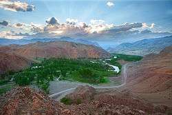
The Chuya
This article is issued from Wikipedia. The text is licensed under Creative Commons - Attribution - Sharealike. Additional terms may apply for the media files.