Chos Malal
Chos Malal is the capital city of the Chos Malal Department in Neuquén Province, Argentina.
Chos Malal | |
|---|---|
City | |
 Seal | |
 Chos Malal  Chos Malal | |
| Coordinates: 37°23′S 70°16′W | |
| Country | |
| Province | |
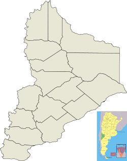
| Department | Chos Malal Department |
| Founded | 4 August 1887 |
| Government | |
| • Mayor | Rolando Figueroa |
| Elevation | 974 m (3,196 ft) |
| Population | |
| • Total | 13,092 |
| CPA Base | Q 8353 |
| Area code(s) | +54 02948 |
| Climate | BSk |
| Website | Chos Malal Municipality |
History
Chos Malal was founded on 4 August 1887 by Colonel José Olascoaga. It developed as a control point for policing the movement of cattle with a view to the suppression of cattle raiding.
The city was the capital of the Territorio del Neuquén until 1904 when the capital and administrative buildings were moved to Neuquén, capital city of the Confluencia Department, the arrival there of the railway having provided an economic boost which helped the city of Neuquén to grow very rapidly.
Geography
Chos Malal is located between the Neuquén River and Curi Leuvú river in the Cordillera del Viento. It is surrounded by conifer forests, mostly of Araucaria trees.
Climate
Chos Malal has a semi-arid climate (Köppen BSk), with cold winters and hot summers; during the winter there are regular snow storms.
| Climate data for Chos Malal (1901–1960) | |||||||||||||
|---|---|---|---|---|---|---|---|---|---|---|---|---|---|
| Month | Jan | Feb | Mar | Apr | May | Jun | Jul | Aug | Sep | Oct | Nov | Dec | Year |
| Record high °C (°F) | 40.6 (105.1) |
40.6 (105.1) |
37.8 (100.0) |
34.2 (93.6) |
30.6 (87.1) |
25.5 (77.9) |
25.1 (77.2) |
29.0 (84.2) |
33.9 (93.0) |
33.4 (92.1) |
37.5 (99.5) |
39.6 (103.3) |
40.6 (105.1) |
| Average high °C (°F) | 31.1 (88.0) |
30.3 (86.5) |
27.4 (81.3) |
22.1 (71.8) |
17.0 (62.6) |
13.2 (55.8) |
12.8 (55.0) |
15.0 (59.0) |
18.2 (64.8) |
22.8 (73.0) |
26.5 (79.7) |
29.2 (84.6) |
22.1 (71.8) |
| Daily mean °C (°F) | 21.3 (70.3) |
20.2 (68.4) |
17.1 (62.8) |
12.6 (54.7) |
9.6 (49.3) |
6.6 (43.9) |
6.1 (43.0) |
7.4 (45.3) |
9.7 (49.5) |
13.7 (56.7) |
17.3 (63.1) |
20.0 (68.0) |
13.5 (56.3) |
| Average low °C (°F) | 12.4 (54.3) |
11.1 (52.0) |
8.3 (46.9) |
4.7 (40.5) |
3.4 (38.1) |
1.3 (34.3) |
0.4 (32.7) |
0.9 (33.6) |
2.8 (37.0) |
5.6 (42.1) |
8.7 (47.7) |
10.6 (51.1) |
5.9 (42.6) |
| Record low °C (°F) | −1.9 (28.6) |
2.0 (35.6) |
−3.0 (26.6) |
−9.1 (15.6) |
−10.6 (12.9) |
−12.5 (9.5) |
−13.9 (7.0) |
−9.6 (14.7) |
−9.1 (15.6) |
−4.5 (23.9) |
−4.2 (24.4) |
−0.6 (30.9) |
−13.9 (7.0) |
| Average precipitation mm (inches) | 10.0 (0.39) |
10.3 (0.41) |
11.0 (0.43) |
17.1 (0.67) |
42.2 (1.66) |
36.3 (1.43) |
32.6 (1.28) |
30.2 (1.19) |
14.6 (0.57) |
13.0 (0.51) |
10.4 (0.41) |
9.4 (0.37) |
237.1 (9.33) |
| Average relative humidity (%) | 40.7 | 44.0 | 32.3 | 53.0 | 58.7 | 62.3 | 61.3 | 57.0 | 51.0 | 44.3 | 41.0 | 39.0 | 48.7 |
| Source: Secretaria de Mineria[1] | |||||||||||||
Culture
The Jose Olascoaga historical museum located in the city has exhibits of many historical pieces of the Conquest of the Desert such as documents, soldier's equipment and Mapuche objects.
References
- "Provincia de Neuquen - Clima Y Meteorologia: Datos Meteorologicos Y Pluviometicos" (in Spanish). Secretaria de Mineria de la Nacion (Argentina). Archived from the original on April 2, 2012. Retrieved February 8, 2014.