Chontacollo
Chontacollo (possibly from Aymara chunta prolonged, lengthened, qullu mountain,[2] "prolonged mountain") is a mountain in the north of the Barroso mountain range in the Andes of Peru, about 5,300 metres (17,388 ft) high. It is situated in the Tacna Region, Tarata Province, Tarata District. Chontacollo lies northwest of the mountain Iñuma.[1]
| Chontacollo | |
|---|---|
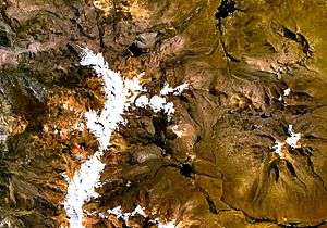 Barroso mountain range (on the left) as seen from space (NASA Landsat) with Chontacollo in the upper part of the range | |
| Highest point | |
| Elevation | 5,300 m (17,400 ft) [1] |
| Coordinates | 17°26′10″S 69°51′12″W |
| Geography | |
 Chontacollo Location within Peru | |
| Location | Peru, Tacna Region |
| Parent range | Andes |
References
- escale.minedu.gob.pe - UGEL map of the Tarata Province (Tacna Region)
- Radio San Gabriel, "Instituto Radiofonico de Promoción Aymara" (IRPA) 1993, Republicado por Instituto de las Lenguas y Literaturas Andinas-Amazónicas (ILLLA-A) 2011, Transcripción del Vocabulario de la Lengua Aymara, P. Ludovico Bertonio 1612 (Spanish-Aymara-Aymara-Spanish dictionary) see: Prolongado
This article is issued from Wikipedia. The text is licensed under Creative Commons - Attribution - Sharealike. Additional terms may apply for the media files.