Guamá, Cuba
Guamá is a municipality in the Santiago de Cuba Province of Cuba. The municipal seat is located in the town of Chivirico. It was named after Guamá, the Taíno cacique who led a rebellion against the Spanish 1530s.
Guamá | |
|---|---|
 | |
.png) Guamá municipality (red) within Santiago Province (yellow) and Cuba | |
| Coordinates: 19°58′33″N 76°24′36″W | |
| Country | Cuba |
| Province | Santiago de Cuba |
| Seat | Chivirico |
| Area | |
| • Total | 964.6 km2 (372.4 sq mi) |
| Elevation | 20 m (70 ft) |
| Population (2004)[1] | |
| • Total | 35,516 |
| • Density | 36.8/km2 (95/sq mi) |
| Time zone | UTC-5 (EST) |
| Area code(s) | +53-226 |
Geography
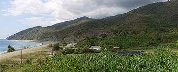
Guamá is located in the south-west of the province, and contains most of the Caribbean Sea coast west of Santiago de Cuba. It includes the town of Chivirico and the villages of Aserradero, Buey Cabón, Caletón Blanco, Cañizo, Cayo Damas, Dos Ríos, El Francés, El Macho, Guamá Abajo, Juan González, La Magdalena, La Mula, La Plata, La Uvita, Las Cuevas, Ocujal, Quiebra Seca, Río Seco and Uvero.
The Pico Turquino, the highest Cuban peak, is located within the municipality.
Demographics
In 2004, the municipality of Guama had a population of 35,516.[1] With a total area of 965 km2 (373 sq mi), it has a population density of 36.8/km2 (95/sq mi).
Transport
The entire municipal coastline is crossed from east to west by the state highway "Circuito Sur de Oriente" (CSO) or Granma Road, which runs along Cuba's southern coast from Santiago de Cuba to the province of Granma.[2]
References
- Santiago.cu (2006). "Municipalities of Santiago de Cuba" (in Spanish). Archived from the original on 2007-12-15. Retrieved 2007-10-05.
- Guama Territory. "Geography". Archived from the original on 2011-07-18. Retrieved 2007-10-05.
External links
| Wikimedia Commons has media related to Guamá, Cuba. |
- (in Spanish) Guamá webpage on santiago.cu
Places adjacent to Guamá, Cuba | |
|---|---|