Chinyalisaur
Chinyalisaur is a small town and tehsil headquarters in the Uttarkashi district of the Indian state of Uttarakhand. It is a semi-urban settlement. It is named after a nearby village called Chinyali. 'Saur' is the Garhrwali word for "plain" area. Chinyalisaur is located along the pilgrimage route to Gangotri, surrounded by small mountains, on the banks of the river Bhagirathi. The Chinyali Saur was the native land of Bisht Thakurs And the Nagraja temple located in the village is the oldest temple here. Due to the land of Bisht Thakurs the patti here had been named as The Bishtpati.
Chinyalisaur चिन्यालीसौड़ Bishtpati | |
|---|---|
Town | |
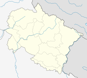 Chinyalisaur Location in Uttarakhand, India  Chinyalisaur Chinyalisaur (India) | |
| Coordinates: 30.583333°N 78.321025°E | |
| Country | |
| State | Uttarakhand |
| District | Uttarkashi |
| Named for | Chinyali village |
| Government | |
| • Type | Tehsil |
| Elevation | 909 m (2,982 ft) |
| Population (2011) | |
| • Total | 15,500 |
| Languages | |
| • Official | Hindi |
| Time zone | UTC+5:30 (IST) |
| PIN | 249196 |
| Telephone code | 91-1371 |
| Vehicle registration | UK-10 |
| Website | uk |
It is located on the banks of the holy river Bhagirathi. It is around 70 kilometres from Chamba, and 34 kilometers from Uttarkashi. It has one intermediate college and one degree college. GIC Inter College has completed its golden 50 years in 2015. The population of the city is about 15,500. The main occupation of the people here is agriculture and government job. Headquarters of Maneri Bhali Hydroelectric Project are also here. Lake formed due to Tehri power project is also cover some area of this town. It is served by Chinyalisaur Airport which is used by the Indian Air Force as an Advanced Landing Ground.[1]
References
- "Indian Air Force to make airbase at Chinaylisaur". Hill Post. 25 September 2011. Retrieved 7 August 2014.