Chelif River
Chelif River (Arabic: وادي الشلف) (also spelled Chéliff, or Sheliff[3]) is a 700-kilometre (430 mi) long river in Algeria and also the longest one in the country. It rises in the Saharan Atlas near the city of Aflou, flows through the Tell Atlas and empties into the Mediterranean Sea north of the city of Mostaganem. The water level in the river often fluctuates. The river is being used for irrigation (mainly on its lower course).
| Chelif | |
|---|---|
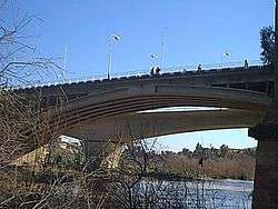 Cheliff Bridge nearby Ech Cheliff | |
| Native name | وادي الشلف |
| Location | |
| Country | Algeria |
| Cities | Mostaganem, Chlef, Aïn Defla, Médéa |
| Physical characteristics | |
| Source | Saharan Atlas |
| Mouth | Mediterranean Sea |
⁃ coordinates | 36°02′22″N 0°07′59″E |
| Length | 725 km (450 mi) |
The river has formerly been called the Mekerra and the Sig River
Notes
References
- EB staff (26 April 2015), "Chelif River - river, Algeria", Encyclopædia Britannica, retrieved 26 April 2015
This article is issued from Wikipedia. The text is licensed under Creative Commons - Attribution - Sharealike. Additional terms may apply for the media files.