Chasseradès
Chasseradès is a former commune in the Lozère department in southern France. On 1 January 2017, it was merged into the new commune Mont Lozère et Goulet.[1]
Chasseradès | |
|---|---|
Part of Mont Lozère et Goulet | |
_village%2C_%C3%A9glise_et_clocher_de_tourmente.JPG) The church tower and surrounding buildings, in Chasseradès | |
Location of Chasseradès 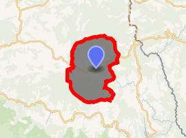
| |
 Chasseradès  Chasseradès | |
| Coordinates: 44°33′07″N 3°49′36″E | |
| Country | France |
| Region | Occitanie |
| Department | Lozère |
| Arrondissement | Mende |
| Canton | Saint-Étienne-du-Valdonnez |
| Commune | Mont Lozère et Goulet |
| Area 1 | 61.93 km2 (23.91 sq mi) |
| Population (1999) | 150 |
| • Density | 2.4/km2 (6.3/sq mi) |
| Time zone | UTC+01:00 (CET) |
| • Summer (DST) | UTC+02:00 (CEST) |
| Postal code | 48250 |
| Elevation | 951–1,482 m (3,120–4,862 ft) (avg. 1,171 m or 3,842 ft) |
| 1 French Land Register data, which excludes lakes, ponds, glaciers > 1 km2 (0.386 sq mi or 247 acres) and river estuaries. | |
The Scottish author Robert Louis Stevenson stayed at an inn in the village of Chasseradès on the night of 27 September 1878, as recounted in his book Travels with a Donkey in the Cévennes.[2] The Robert Louis Stevenson Trail (GR 70), a popular long-distance path following Stevenson's approximate route, runs through the village.[3]
Geography
The commune is traversed by the river Chassezac.
See also
References
- Arrêté préfectoral 23 May 2016 (in French)
- Stevenson, Robert Louis (1905) [1879]. . Travels with a Donkey in the Cevennes. New York: Charles Scribner's Sons. p. – via Wikisource.
- Castle, Alan (2007). The Robert Louis Stevenson Trail (2nd ed.). Cicerone. pp. 122–126. ISBN 978-1-85284-511-7.
External links
| Wikimedia Commons has media related to Chasseradès. |
- Chasserades in Lozere (French; photographs)
- Stevenson Trail GR70 Hiking trail
| Authority control |
|
|---|
This article is issued from Wikipedia. The text is licensed under Creative Commons - Attribution - Sharealike. Additional terms may apply for the media files.