Central European Highlands
The Central European Highlands, in a broad sense, comprise the high mountains of the Alpine Mountains and the Carpathian Mountains systems along with mountainous ranges of medium elevation (between about 1000 and 2000 m a.s.l.), e.g. those belonging to the Bohemian Massif, still prevailingly of mountainous character.
Both types of mountains act as ”water towers”. Their high elevation brings about high precipitation and low evaporation, and the resulting surplus of water balance feeds large European rivers and other important water sources. Beside the mountains, large areas of Central Europe are occupied by highlands or peneplains of lower altitude (between 400 and 800 m) in which the surplus of annual water balance is less noticeable.
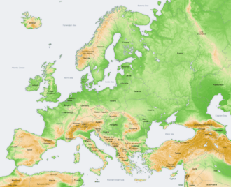
It includes the uplands of central and south western Europe. Blocks of elevated highlands are found as dissected plateaus and faulted valleys. These are Messeta plateau of Iberian peninsula, Central massif of France, the highlands of Brittany and south west Ireland, the Rhine highlands, the Vosges, the Black Forest of the Rhine and so on. These are on the map.