Centennial, Winnipeg
Centennial is an inner-city neighbourhood located Winnipeg, Manitoba in the Downtown East Neighbourhood Cluster. The boundaries of Centennial are; Sherbrook Street on the west, Logan Avenue on the north, William Avenue on the south and Stanley, Paulin and Adelaide streets on the east.[2]
Centennial | |
|---|---|
Neighbourhood | |
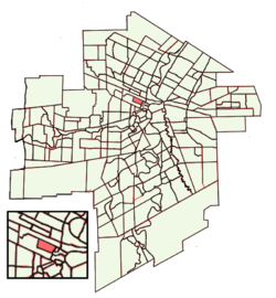 Location of Centennial within Winnipeg | |
| Country | |
| Province | |
| City | Winnipeg |
| Area | |
| • Land | 0.5 km2 (0.2 sq mi) |
| Population (2006) | |
| • Total | 2,225 |
| • Density | 4,176.5/km2 (10,817/sq mi) |
| Racial Group | |
| • White | 26.3% |
| • Aboriginal | 44.7% |
| • Visible minority | 29.0% |
| Locations Type | Location |
| • Neighbourhood Cluster | Downtown East |
| • Community Area | Downtown |
| • Police District | District 1 |
| • City Council Ward | Point Douglas Ward |
| [1] | |
Demographics
In 2006, the population of Centennial was 2,225 people, which has been on a near-steady drop since 1971 when the population was 3,510.[1] Centennial does not have a majority racial group as it is 26.3% White, 44.7% Aboriginal and 29.0% is made up of visible minorities; 12.1% Southeast Asian, 9.4% Black, 5.2% East Asian and the rest of other groups.
Centennial is a lower income neighbourhood, with a median household income of $15,206, which is more than 3 times less than the cities at $49,790. There are 910 dwellings, 20.9% which are owned and the average dwelling is worth $53,440. 18.6% of these dwellings are in need of major repairs.
Crime
Centennial has very high crime rates, violent crimes specifically. There were 11 homicides in the area from 2012, to 2016. In 2016, there were 36 robberies (1618.0 per 100,000 residents), 23 auto-thefts (629.2), 46 break-ins (2067.4) and 21 shootings (224.7).[3] All of these rates are not only significantly higher than the national rates, but much higher than the city-wide rates. The robbery rate is more than 20 times the national rate (79 per 100,000 residents).[4] This robbery rate is the 9th highest of all the neighborhoods in Winnipeg with populations over 1,000 residents, 15th (of 234) in total.
Points of Interest
Parks and Playgrounds
- Dufferin Park
- Dufferin and Isabel park
- Lizzie Playground
- Ross Ellen Playground
- Roosevelt Playground
- Pacific Avenue Tot Lot
- Ellen and Pacific Tot Lot
- Central Park
Places of Religion
- Vietnamese Mennonite Church
- Wide World of Faith Church
- Amazing Grace Ministry
References
- 2006 Census (Centennial). Retrieved December 3rd, 2013
- Neighborhoods of Winnipeg Website, Retrieved December 3rd, 2013
- Crime in Winnipeg by Neighbourhoods (2012), info gathered from CrimeStat. Retrieved December 3rd, 2013
- Police-reported crime for selected offences, Canada, 2011 and 2012. Retrieved December 3rd, 2013