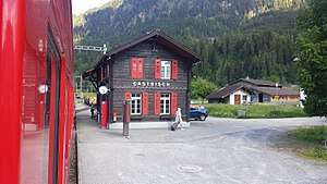
Castrisch (Rhaetian Railway station)
Castrisch is a railway station on the Reichenau-Tamins–Disentis/Mustér railway of the Rhaetian Railway in the Swiss canton of Graubünden. It serves the village of Castrisch in the municipality of Ilanz/Glion.[1][2]
Castrisch | |||||
|---|---|---|---|---|---|
 Castrisch station | |||||
| Location | Via dalla Staziun 98 7126 Castrisch Surselva, Graubünden Switzerland | ||||
| Coordinates | 46°46′43″N 09°13′59″E | ||||
| Elevation | 705 m (2,313 ft) | ||||
| Owned by | Rhaetian Railway (RhB) | ||||
| Operated by | RhB | ||||
| Line(s) | Landquart - Disentis/Mustér | ||||
| Distance | 40.74 km (25.31 mi) from Landquart | ||||
| History | |||||
| Opened | 1 June 1903 | ||||
| Electrified | 22 May 1922 | ||||
| |||||
| Location | |||||
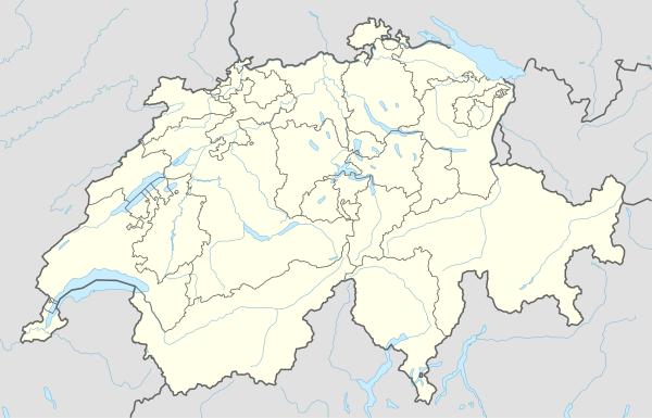 Castrisch Location within Switzerland | |||||

Services
The station is served by trains on the RE3/R31 services, which provide 1 train per hour in both directions.[2][3]
| Preceding station | Rhätische Bahn | Following station | ||
|---|---|---|---|---|
toward Disentis/Mustér | RE3 RE910/RE920 | toward Scuol-Tarasp |
||
| R31 R910/R920 Limited service | toward Landquart |
Gallery
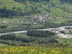 The station can be seen in the centre of the image
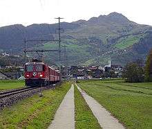 Rail line through Castrisch
References
- "106 - Glarnerland - Bündnerland" (Map). Castrisch railway station (2015 ed.). 1:100 000. National Map 1:100'000. Federal Office of Topography - swisstopo. ISBN 978-3-302-50106-2. Retrieved 2017-06-05 – via map.geo.admin.ch.
- "Rail network". Rhaetian Railway. Archived from the original on 2017-06-05. Retrieved 2017-06-05.
- "Chur–Disentis/Mustér–Andermatt" [Official Timetable of Switzerland] (PDF). Offiziellen Kursbuches der Schweiz (in German). Archived (PDF) from the original on 2017-06-06. Retrieved 2017-06-06.
This article is issued from Wikipedia. The text is licensed under Creative Commons - Attribution - Sharealike. Additional terms may apply for the media files.