Castellvi Peak
Castellvi Peak (Bulgarian: връх Кастелви, romanized: vrah Kastelvi, IPA: [ˈvrɤx kɐˈstɛɫvi]) is a peak rising to 350 m on Hurd Peninsula, Livingston Island. Situated 800 m northeast of MacGregor Peaks and 1.4 km southwest of Dorotea Peak. Spanish early mapping in 1991. Named for Josefina Castellví i Piulachs, a doyen of the Spanish Antarctic Program.
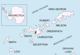
Location of Hurd Peninsula on Livingston Island in the South Shetland Islands.
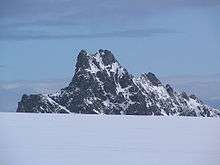
Castellvi Peak from Hurd Ice Cap.
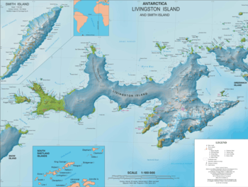
Topographic map of Livingston Island and Smith Island.
Maps
- Isla Livingston: Península Hurd. Mapa topográfico de escala 1:25000. Madrid: Servicio Geográfico del Ejército, 1991. (Map reproduced on p. 16 of the linked work)
- L.L. Ivanov et al. Antarctica: Livingston Island and Greenwich Island, South Shetland Islands. Scale 1:100000 topographic map. Sofia: Antarctic Place-names Commission of Bulgaria, 2005.
- L.L. Ivanov. Antarctica: Livingston Island and Greenwich, Robert, Snow and Smith Islands. Scale 1:120000 topographic map. Troyan: Manfred Wörner Foundation, 2009. ISBN 978-954-92032-6-4
- Antarctic Digital Database (ADD). Scale 1:250000 topographic map of Antarctica. Scientific Committee on Antarctic Research (SCAR). Since 1993, regularly upgraded and updated.
- L.L. Ivanov. Antarctica: Livingston Island and Smith Island. Scale 1:100000 topographic map. Manfred Wörner Foundation, 2017. ISBN 978-619-90008-3-0
References
- Castellvi Peak. SCAR Composite Antarctic Gazetteer
- Bulgarian Antarctic Gazetteer. Antarctic Place-names Commission. (details in Bulgarian, basic data in English)
External links
- Castellvi Peak. Copernix satellite image
This article includes information from the Antarctic Place-names Commission of Bulgaria which is used with permission.
This article is issued from Wikipedia. The text is licensed under Creative Commons - Attribution - Sharealike. Additional terms may apply for the media files.