Carleton Heights
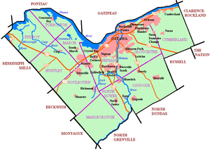
Carleton Heights is a neighbourhood in River Ward in Ottawa, Ontario, Canada. According to the Carleton Heights and Area Community Association, the neighbourhood is bounded on the north by the Central Experimental Farm, on the east by the Rideau River, on the south by the junction of Prince of Wales Drive and Fisher Avenue and on the west by Fisher Avenue.[1] The neighbourhood is sometimes referred to as Hog's Back after the nearby falls. The total population of the neighbourhood is 7,586 according to the Canada 2016 Census.[2]
Carleton Heights | |
|---|---|
Neighbourhood | |
 Carleton Heights | |
| Coordinates: 45°22′00″N 75°42′20″W | |
| Country | Canada |
| Province | Ontario |
| City | Ottawa |
| Population (Canada 2016 Census) | |
| • Total | 7,586 |
| Time zone | Eastern (EST) |
The main street is Normandy Cr.
Carleton Heights homes were developed after World War II. Most of the homes were not built until 1950. More homes were built in the 1960s and 1970s. The 'vet' homes were built on half acre lots and the owners sold off half the lot on which new more expensive homes were built beginning in the '60s. Most of the 'vet' homes are still there
Carleton Heights has a community centre which is adjacent to the Carleton Heights Curling Club and Carleton Heights Public School.
Sub neighbourhoods
See also
- List of Ottawa neighbourhoods
- Geography of Ottawa
References
- https://ourchara.ca/wp-content/uploads/charabylaws2012final.pdf
- Population calculated by combining Census Tracts 0020.01 and 0020.02 and subtracting Census Blocks west of Fisher (35060533008, 35060533003, 35060535006, 35061831006, 35061831009) and Carleton University (block 35061835007)
External links
| Infrastructure | |
|---|---|
| Sport in Ottawa | |
| Entertainment and festivals | |
| Museums |
|
| Parks, squares, and natural landmarks | |
| Historical | |
| Demolished structures | |
| Shopping | |
| Neighbourhoods | |
| |
| History | |
|---|---|
| Geography | |
| Culture |
|
| Public services | |
| Education | |
| Government | |
| Transportation | |
| Features | |
| |