Capistrano Beach, Dana Point, California
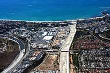
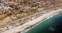
Capistrano Beach, also known as Capo Beach, is a coastal neighborhood in the city of Dana Point in Orange County, California.[2] It is bordered by San Clemente to the south and Doheny State Beach to the north.
Capistrano Beach | |
|---|---|
District of Dana Point | |
 Capistrano Beach | |
| Coordinates: 33°27′45″N 117°40′18″W[1] | |
| Country | United States |
| State | California |
| County | Orange |
| City | Dana Point |
| Elevation | 51 ft (16 m) |
| Time zone | UTC-8 (PST) |
| • Summer (DST) | UTC-7 (PDT) |
| ZIP code | 92624 |
| Area code(s) | 949 |
Capistrano Beach is situated along the coast on the southern end of Dana Point. Homes range from beach cottages to some of the finest real estate in Orange County. Many multimillion-dollar homes can be found in the area, with some situated atop a cliff overlooking Coast Highway and the Capistrano Beach park below. Several celebrities live in the town area, notably on Beach Road, where Hobie Alter conceived of the popular Hobie Cat catamaran.[3] There are modest, older homes a little farther from the shore.
History
Originally a part of Rancho Boca de la Playa, the area now known as Capistrano Beach was known as Serra[1] in the late 1880s when the California Central Railway was first extending down from Los Angeles.[4] The land was sold to the San Bernardino and San Diego Railway.[5] Development of Capistrano Beach started in 1925 with residential homes on the bluff. The Capistrano Beach Club was built along the shore of the new development. In 1929, the Petroleum Securities Company (owned by Edward L. Doheny) became the new owners of the Capistrano Beach development.[6] In 1931, following the death of Doheny's son, he donated over 40 acres (16 ha) to the state for Doheny State Beach.[7] Capistrano Beach became part of the city of Dana Point in 1989.[8]
During the excavation of the land during development, the bones of a mastodon (or possibly a mammoth) were discovered in 2016.[9]
The 1,180 feet (360 m) wooden pier is popular for strolling, sightseeing, and fishing. The pier was severely damaged by waves in 1964, after which it was condemned and demolisded 1965.[10] The Capistrano Beach Club became rundown and, in the late 1960s, was dismantled.[6]
During storms in 2018, a boardwalk collapsed and an outdoor basketball court was severely damaged after being undermined by erosion caused by the waves. The storm exposed old cars put there decades prior as part of a now corroded sea wall. More Boulders were placed to protect the basketball court that was damaged.[11][12]
References
- "Capistrano Beach". Geographic Names Information System. United States Geological Survey.
- "Capistrano Beach County Park". Los Angeles Times. Archived from the original on July 6, 2009. Retrieved 2009-06-02.
- http://www.danapointtimes.com/hobie-alter-farewell-to-a-pioneer-of-fun/
- "The Beach Road Story | San Clemente Life". www.sanclementelife.com. Archived from the original on 2017-11-13. Retrieved 2018-10-07.
- "It's History: Rancho Boca de la Playa Plants Capistrano Beach Roots". Dana Point Times. Retrieved 2016-03-21.
- "It's History: A Lost Beachfront Treasure". Dana Point Times. Retrieved 2016-03-21.
- "Tracing the history of Dana Point". The Orange County Register. Retrieved 2016-03-21.
- "How Capo Beach became a part of Dana Point". The Orange County Register. Retrieved 2016-03-21.
- "It's History: The Capistrano Mastadon [sic]". Dana Point Times. Retrieved 2016-03-21.
- "It's History: Capistrano Pier, Only Memories Remain". Dana Point Times. Retrieved 2016-03-21.
- Connelly, Laylan. "Capo Beach crumbles with walkway destroyed, palms uprooted, old buried cars exposed from surf battering". OC Register. Retrieved 2018-01-08.
- Do, Ahn (2018-12-07). "Residents fear losing Capistrano Beach as storms chip away at their 'piece of paradise'". Los Angeles Times. Retrieved 2019-10-03.
External links