Cape Renard
Cape Renard (65°1′15″S 63°46′12″W) is a cape forming the south side of the entrance to Flandres Bay and separating the Danco and Graham Coasts on the west coast of Antarctic Peninsula. Situated on the minor Renard Island just off the north extremity of Kiev Peninsula, and surmounted by Una's Peaks. Discovered in 1898 by the Belgian Antarctic Expedition under Gerlache and named by him for Professor A. Renard, a member of the Belgica Commission and of the Belgian Royal Academy.
 Cape Renard[1] Antarctica | |

| |
| Location | Cape Renard Antarctic Peninsula Antarctica |
|---|---|
| Coordinates | 65°01′11″S 63°46′14″W |
| Year first constructed | n/a |
| Foundation | concrete base |
| Construction | fiber glass tower[1] |
| Tower shape | cyldrical tower with balcony and light |
| Markings / pattern | white tower with red band[1] |
| Tower height | 3 metres (9.8 ft)[1] |
| Focal height | 7 metres (23 ft)[1] |
| Light source | solar power |
| Range | 5 nautical miles (9.3 km; 5.8 mi)[1] |
| Characteristic | Fl W 10s.[1] |
| Admiralty number | G1401[1] |
| NGA number | 2793[1] |
Azufre Point lies about 3 miles (5 km) southeast.
Maps
- Antarctic Digital Database (ADD). Scale 1:250000 topographic map of Antarctica. Scientific Committee on Antarctic Research (SCAR). Since 1993, regularly upgraded and updated.
See also
References

Cape Renard with Una's Peaks on the left, Booth Island on the right, and between them Lemaire Channel
![]()
![]()
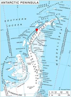
300pxLocation of Kiev Peninsula in Graham Land, Antarctic Peninsula.
This article is issued from Wikipedia. The text is licensed under Creative Commons - Attribution - Sharealike. Additional terms may apply for the media files.