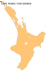
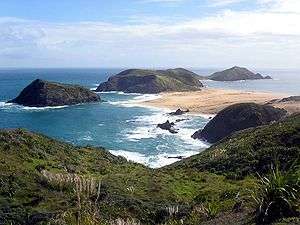
Cape Maria van Diemen
Cape Maria van Diemen is the westernmost point of the North Island of New Zealand. A tombolo, it was originally an island composed mainly of basaltic-andesitic lava flows and dykes.[1] Drifting sands joined it to the rest of the North Island during the late Pleistocene.
The cape was named by Abel Tasman, (first European explorer to discover New Zealand) after the wife of his patron, Anthony van Diemen, Governor General of Batavia (now Jakarta) in January 1643, on the same voyage of discovery during which he named Van Diemen's Land (now Tasmania). It is - along with the Three Kings Islands - one of only two geographic features in New Zealand to retain the names given to them by Tasman.
Climate
Cape Maria van Diemen normally has a subtropical climate, but it is the most northerly part of New Zealand in which snowfall has been reported.[2]
References
- Nicholson, K. N. (2006). Unraveling the Complex Volcanic History of Northland New Zealand (abstract).
- "Cape Maria Fall" (Volume LXXVI, Issue 23413). New Zealand Herald. 1 August 1939. Retrieved 28 May 2018.
.jpg)