Caonillas, Aibonito, Puerto Rico
Caonillas is a barrio in the municipality of Aibonito, Puerto Rico. Its population in 2010 was 1,424.[3][4][5]
Caonillas | |
|---|---|
Barrio | |
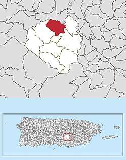 Location of Caonillas within Aibonito in Puerto Rico | |
| Coordinates: 18°09′36″N 66°15′50″W[1] | |
| Commonwealth | |
| Municipality | |
| Area | |
| • Total | 2.79 sq mi (7.2 km2) |
| • Land | 2.79 sq mi (7.2 km2) |
| • Water | 0.00 sq mi (0.0 km2) |
| Elevation | 1,808 ft (551 m) |
| Population (2010) | |
| • Total | 1,424 |
| • Density | 510.4/sq mi (197.1/km2) |
| Source: 2010 Census | |
| Time zone | UTC−4 (AST) |
History
The United States took control of Puerto Rico from Spain in the aftermath of the Spanish-American War under the terms of the Treaty of Paris of 1898. In 1899, the United States conducted its first census of Puerto Rico finding that the combined population of Caonillas and Asomante barrios was 1,245.[6]
As an electoral unit
In 2016, the following areas, sectors and neighborhoods were included in the Caonillas barrio electoral unit: Sector Bambúa, Sector La Tea, La Vega, Sector Bejucos, Sector Corea, Sector Quenepo, Sector Verdún, Parcelas Viejas, Parcelas Nuevas, Desvío Robles, Sector El Coquí, and Sector Escuelas.[7]
Special communities
Since 2001 when law 1-2001 was passed,[8] measures have been taken to identify and address the high levels of poverty and the lack of resources and opportunities affecting specific communities in Puerto Rico. Initially there were 686 places that made the list.[9] By 2008, there were 742 places on the list of Comunidades especiales de Puerto Rico. The places on the list are barrios, communities, sectors, or neighborhoods and in 2004 Sector El Coquí in Caonillas made the list.[9] In 2017, Jesus Velez Vargas, the director of the Special Communities of Puerto Rico program stated that the program was evolving with more ways to help the residents of these so-called marginal communities.[10][11]
See also
References
- "US Gazetteer 2019". US Census. US Government.
- U.S. Geological Survey Geographic Names Information System: Caonillas barrio
- Picó, Rafael; Buitrago de Santiago, Zayda; Berrios, Hector H. Nueva geografía de Puerto Rico: física, económica, y social, por Rafael Picó. Con la colaboración de Zayda Buitrago de Santiago y Héctor H. Berrios. San Juan Editorial Universitaria, Universidad de Puerto Rico,1969.
- Gwillim Law (20 May 2015). Administrative Subdivisions of Countries: A Comprehensive World Reference, 1900 through 1998. McFarland. p. 300. ISBN 978-1-4766-0447-3. Retrieved 25 December 2018.
- Puerto Rico:2010:population and housing unit counts.pdf (PDF). U.S. Dept. of Commerce, Economics and Statistics Administration, U.S. Census Bureau. 2010.
- Joseph Prentiss Sanger; Henry Gannett; Walter Francis Willcox (1900). Informe sobre el censo de Puerto Rico, 1899, United States. War Dept. Porto Rico Census Office (in Spanish). Imprenta del gobierno. p. 164.
- "Voting Centers for 2016 Elections" (PDF). Comisión Estatal de Elecciones (in Spanish). Estado Libre Asociado de Puerto Rico. Retrieved 2 July 2019.
- "Leyes del 2001". Lex Juris Puerto Rico (in Spanish). Retrieved 24 June 2019.
- "Comunidades Especiales de Puerto Rico" (in Spanish). 8 August 2011. Retrieved 24 June 2019.
- "Evoluciona el proyecto de Comunidades Especiales". El Nuevo Dia (in Spanish). 24 February 2017. Retrieved 24 June 2019.
- ElVocero.com, Por. "Ya es ley Oficina para el Desarrollo Socioeconómico y Comunitario". El Vocero de Puerto Rico (in Spanish). Retrieved 24 June 2019.