Camp Stoneman
Camp Stoneman was a United States Army military facility located in Pittsburg, California. It served as a major staging area for the Army in World War II and the Korean War.

Camp Stoneman opened May 28, 1942, for the purpose of staging troops for the Pacific Theater of Operations. The camp was named after George Stoneman, a cavalry commander during the Civil War, and Governor of California. It was decommissioned as a military post in 1954.
.jpg)
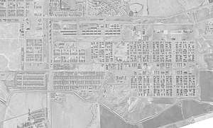
The camp had a railroad track across the north side for receiving and shipping men. Next to this were many buildings with loading docks, many which were still there in 2017 along Bliss Avenue. There were seven barracks areas, each consisting of nine blocks (3 x 3) surrounding a mess hall. The Italian Service Unit of the 18th Italian Quartermaster Service Company worked at the camp.[1]
Units staged at Camp Stoneman
- 13th Troop Carrier Squadron, October 10 to November 1, 1942
- 2nd Infantry Division
- 172nd Infantry Regiment
- 4th Engineer Special Brigade
- 5th Cavalry Regiment World War II combat survivors of Company B, 124th Infantry Regiment, 31st Infantry Division, at Camp Stoneman in December 1945.
- 7th Cavalry Regiment
- 86th Infantry Division deployed from Camp Gruber, OK, staged at Camp Stoneman 14–21 August 1945 then departed SFPOE to the Philippines[2]
- 805th Engineer Aviation Battalion
- 2nd Filipino Infantry Regiment[3]
345th Bombardment Group (Air Apaches)
References
- militarymuseum.org, Prisoner of War Camps and Italian Service Units in California
- Stanton, Shelby L. (1991). Wortld War II Order of Battle. New York: Galahad Books. p. 158. ISBN 0-88365-775-9.
- "2d Filipino Battalion (Separate) (Formerly 1st Battalion, 2d Filipino Regiment) Service Summary". history.army.mil. United States Army. Retrieved 13 May 2015.
- The California State Military Museum