Cabonga Reservoir
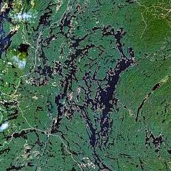
The Cabonga Reservoir (French: Réservoir Cabonga) is a man-made lake in central Quebec, Canada, with a total surface area of 677 square kilometres (261 sq mi) and a net area (water only) of 484 square kilometres (187 sq mi).[2] It is located on the boundary between the unorganized territories of Lac-Pythonga and Réservoir-Dozois, and fully within the La Vérendrye Wildlife Reserve. The First Nations reserve of Rapide Lake is on its western shores.
| Cabonga Reservoir | |
|---|---|
 | |
| Location | Lac-Pythonga and Réservoir-Dozois, La Vallée-de-l'Or Regional County Municipality, Quebec |
| Coordinates | 47°19′57″N 76°34′37″W |
| Type | Artificial |
| Primary inflows | Cabonga River |
| Primary outflows | Gens de Terre River Ottawa River |
| Basin countries | Canada |
| Surface area | 677 km2 (261 sq mi)[1] |
| Shore length1 | 4,500 km (2,800 mi) |
| Surface elevation | 361 m (1,184 ft)[1] |
| 1 Shore length is not a well-defined measure. | |
Its name is derived from the Algonquin kakibonga and means "completely blocked by sand."[3]
The reservoir has 2 outlets: the Gens de Terre River flowing to the south-east which is a tributary of the Baskatong Reservoir and Gatineau River; and an outflow to the north-west flowing directly into Barrière Lake which is part of the Ottawa River system. Both outflows are controlled by dams to regulate the flow on these respective rivers.[3]
Many fishing magazines and websites consider Cabonga Reservoir one of North America's top 20 walleye and northern pike waters.[4] And Outdoor Canada magazine includes it among its "simply the best" hot spots for lake trout fishing.[5]
History
Before its impoundment, Lake Cabonga was considered the largest body of water between the Gatineau and Ottawa Rivers. In 1851, the Hudson's Bay Company established a trading post at this lake (named Kakabonga at that time). The post burned down in 1873, and was not rebuilt but replaced by a new post on Barrière Lake. In 1928-1929, a dam at the outlet of the lake, the Gens de Terre River, was constructed to create a water reserve for logging companies to float their logs downstream. Some 37 natural lakes were thus combined and formed a single reservoir with an area of 404 square kilometres (156 sq mi), dotted with innumerable islands (some with considerable proportions) and deep bays.[3][4][6]
Surveyor H. C. Symmes, in a report dating from 1864, used "Kakibonga" to designate the lake. In 1911, one map named it "Lake Kakabonga". Finally in 1924, the Commission de Géographie approved its current name.[3]
Fauna
Fish species found in the lake are: lake trout, yellow walleye, northern pike, lake sturgeon, lake whitefish, sauger, white sucker, and yellow perch.
See also
- Zec Capitachouane
- Dozois Reservoir, nearby large reservoir downstream on the Ottawa River
References
- Statistics Canada > summary tables > Principal lakes, elevation and area, by provinces and territories Archived 2011-07-06 at the Wayback Machine
- Natural Resources Canada, Atlas of Canada - Lakes
- "Réservoir Cabonga" (in French). Commission de toponymie du Québec. Retrieved 2010-12-14.
- "Cabonga Reservoir". Deer Horn Lodge. Archived from the original on 2009-01-23. Retrieved 2008-09-22.
- "Hot Spots, Simply the Best". Outdoor Canada. Archived from the original on 2007-11-11. Retrieved 2008-09-25.
- "Lac-Rapide (Réserve indienne)" (in French). Commission de toponymie du Québec. Retrieved 2010-03-18.