Bung Bong
Bung Bong is a township in Victoria between the rural towns of Avoca and Maryborough. The township is divided, with the Western section in the Pyrenees Shire and the Eastern section in Shire of Central Goldfields. The Bet Bet Creek (which separates the two Shires) runs towards the north through the middle of the township and then into the Loddon River. Bung Bong is located on the Pyrenees Highway.
| Bung Bong township Victoria | |
|---|---|
 The 1876 Temperance Hall / Church of England, 1 km east of the old Bung Bong township | |
 Bung Bong township | |
| Coordinates | 37°06.203862′S 143°33.679002′E |
| Population | 51 (2016 census)[1] |
| Postcode(s) | 3465 |
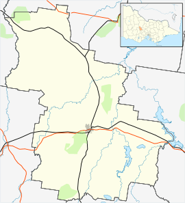
| Location |
|
| LGA(s) |
|
| State electorate(s) | Ripon |
| Federal Division(s) | Mallee |
It is reported that the name 'Bung Bong' derives from the aboriginal words for 'swamp'[2] or for 'swamp grass'.[3]
Bung Bong is also a region, which has a large range of native flora and fauna,[4][5] South-East of the township is the Bung Bong Nature Conservation Reserve which is used by bush walkers and bird watchers.[6][7]
Activities
In 1878 the Bung Bong Farmers' Club held their first "ploughing match". There were 18 entries in the competition to plough, "virgin soil, of a rich chocolate colour". It was reported, "that although the ploughmen were new to competitive trials, they showed by the excellence of their work their fitness for their calling."[8] For the 1886 (and ninth) ploughing match there were 22 entries. It was held on the Abbott property, half a mile from the Bung Bong railway station and "the attendance was large". This time, 10 entrants used double furrow ploughs with one entrant, "exhibiting Gilsman's patent rotary harrows, which attracted great attention, and were pronounced excellent implements".[9]
At the Wareek Hall there is an Honour Roll, of those from the Bung Bong district, who fought in World War 1. It contains 19 names, including 5 names of those who did not return.[10]
Local volunteers[11] have fought major bushfires in the region in December 1880,[12] January 1881,[13] January 1985[14][15] and the Black Saturday bushfires in 2009.[16]
Bung Bong horse, Richmond Lass, won 31 races and went on to win the 1969 Inter Dominion Pacing Championship.[17] The horse was owned by Fred Miller of Richmond House.[14]
Gold has been extracted in the Bung Bong region[18] and along the Bet Bet Creek. In 2018, commercial gold exploration has resumed.[19]
Infrastructure
Copies of the land titles for the Bung Bong township, located on what subsequently became the Pyrenees Highway, at the Bet Bet Creek, for 1863 and for 1873 are available.[20] The township area is now designated as the Bung Bong Streamside Reserve.[21] Bung Bong Post Office opened on 1 February 1864 and closed in 1961.[22]
At the Bung Bong township, the old Glenmona Bridge was built over the Bet Bet Creek in 1871 and is the third oldest of its type in Victoria, (after the Hawthorn Bridge and the Redesdale Bridge). Its location is directly south of the new bridge over the Bet Bet on the Pyrenees Highway.[15]
The Pyrenees Shire Council has documented a number of significant properties in the Bung Bong - Homebush region in the Avoca Heritage Study: 1864 - 1994 - Volume 3.[23]
Railway

Bung Bong is on the Avoca railway line, to the north of the town, where ballast was loaded from nearby basalt quarries. There was a Post Office at the Bung Bong station which opened in October 1877 and closed in June 1940.[22]
In 2017, there is a proposal entitled the, Murray Basin rail project designed to link Mildura to Portland with standard gauge track to carry grain and mineral sands. This upgrading will include the Maryborough to Ararat section of the line, past the site of the disused Bung Bong station. ( Coordinates 37.0545851°S 143.6070974°E )[24][25][26] Community action has been successful in keeping a railway level crossing on a key arterial road open, after commencement of the new rail link.[27]
The Avoca line was reopened in 2018 after a complete rebuild as part of the Murray Basin Rail Project, which also extended the reach of the standard gauge network in Victoria.[28]
Bung Bong, Wareek Cemetery

The cemetery is located at 413 Bung Bong-Rathscar Rd, Wareek VIC 3465. ( Coordinates 37°02.549′S 143°35.152′E ) and in 2017 is being upgraded by the community with new fences and facilities.
Information on the interments,[29] with more details and images of the headstones - here.[30]
Schools
There was a Primary School (No. 1056) at Bung Bong which operated on the same block as the Church of England between 1872 and 1921.[31][32] Approximately 5 km south of Bung Bong, on the Moore's Flat Road, is the now abandoned locality of Moore's Flat. There was a Moore's Flat Primary School (No. 1575).[33][34]
Hall
The Bung Bong Temperance Hall was established by the Independent Order of Rechabites as 'Tent' 138.[35][36] It is located on the Pyrenees Highway. ( Coordinates 37°5.8405′S 143°34.1539′E ) It was built in 1876 on land donated by Mr Miller and was used for community activities including meetings of the 'Farmers Club'.[37] The building was subsequently used as the Bung Bong Church of England.[38] While the building is now unused, the site has become a popular stopping place for caravans.[39]


See also
References
- Australian Bureau of Statistics (27 June 2017). "Bung Bong (State Suburb)". 2016 Census QuickStats. Retrieved 18 March 2018.

- "1907 Victoria Place Names".
- "From the Ruins of Colonialism: History as Social Memory".
- "Flora" (PDF). Data From: Atlas of Victorian Wildlife, Biodiversity and Natural Resources. May 2005. Archived from the original on 19 October 2009. Retrieved 22 June 2017.CS1 maint: BOT: original-url status unknown (link)
- "Fauna" (PDF). Data From: Atlas of Victorian Wildlife, Biodiversity and Natural Resources. May 2005. Archived from the original on 19 October 2009. Retrieved 22 June 2017.CS1 maint: BOT: original-url status unknown (link)
- "Bung Bong Nature Conservation Reserve". Parks Victoria. 2017. Retrieved 22 June 2017.
- "Bung Bong Nature Conservation Reserve., Victoria, AU". Cornell Lab of Ornithology. 13 November 2014. Retrieved 22 June 2017.
- "Ploughing Matches: Bung Bong". The Australasian - cited from the Maryborough Standard. 13 July 1878. Retrieved 22 June 2017.
- "Ploughing Matches: The Bung Bong Match". The Argus. 7 August 1886. Retrieved 22 June 2017.
- "Bung Bong District roll of honour". Monument Australia.
- "Faces of CFA: Ken Calder". 3 May 2017.
- "A disastrous bush fire". 20 December 1880.
- "News scraps". Kyneton Guardian. 1 January 1881.
- "Can Girl match the feats of Lass?". Harness News. 11 June 2016. Retrieved 14 June 2017.
- "Bet Bet Creek Road Bridge (Place ID 16055)". Australian Heritage Database. Department of the Environment.
- "Generous donation for Wareek & Bung Bong Fire Brigade". 3 October 2016.
- Harness Racing,Wayville (S.A) 01/03/1969 Inter-Dominion Grand Final (Richmond Lass-K.Brook). 22 August 2014. Retrieved 14 June 2017.
- "Mystic Peak Reef". The Argus. Retrieved 30 July 2018.
- "ECR Minerals completes Bung Bong gold drilling". Proactive Investors. 2 December 1937. Retrieved 30 July 2018.
- "Bung Bong land titles 1863 and 1873". 1863.
- "Bung Bong Streamside Reserve". 2017.
- Premier Postal History. "Post Office List". Retrieved 21 May 2012.
- "Avoca Heritage Study: 1864 - 1994, Volume 3". Pyrenees Shire Council. February 1995. pp. 148–171. Archived from the original on 14 March 2018. Retrieved 20 June 2017.
- "Murray Basin Rail Project". Public Transport Victoria. 2013. Archived from the original on 4 August 2017. Retrieved 22 June 2017.
- Hunt, Peter (26 May 2017). "Rail freight Victoria: Works to cause more delays for grain". The Weekly Times. Retrieved 22 June 2017.
- "Murray Basin rail project".
- Steed, Lachy (14 July 2017). "Relief at decision to keep key road open". Maryborough Advertiser. Retrieved 18 September 2017.
- Martinich, Rex (30 January 2018). "Ararat rail freight is back after 13 years sitting idle". The Courier. Retrieved 10 March 2018.
- "Wareek Bung Bong Cemetery". February 2009.
- "Bung Bong & Wareek Cemetery". 2006.
- "Bung Bong Primary School". Public Records Office Victoria. Retrieved 26 July 2018.
- "Bung Bong People's Liberal Party". Maryborough and Dunolly Advertiser. 20 March 1914. Retrieved 26 July 2018.
- "Moore's Flat Primary School". Public Record Office. Retrieved 26 July 2018.
- "Moore's Flat Primary School". Maryborough and Dunolly Advertiser. 29 June 1914. Retrieved 26 July 2018.
- "The opening of the "On to Victory (138)" tent of I. O. R." The Avoca Mail. 25 November 1870.
- Stout, Robert. "Victorian Tent Register". New Zealand Electronic text collection. p. 70.
- "The Bung Bong Farmers Club". Avoca Mail. 16 August 1878.
- "Bung Bong Anglican Church - Former". Churches Australia. 30 July 2018. Retrieved 30 July 2018.
- "Bung Bong Rest Area". Caravan on Tour. Retrieved 15 June 2017.
External links
![]()
| Wikivoyage has a travel guide for Bung Bong. |