Buckton, East Riding of Yorkshire
Buckton is a small village, which is part of the civil parish of Bempton in the East Riding of Yorkshire, England.[1] It is near the North Sea coast, and about 4 miles (6 km) north of Bridlington.[2] It lies on the B1229 road.[3]
| Buckton | |
|---|---|
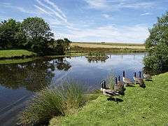 Duck pond, Buckton | |
 Buckton Location within the East Riding of Yorkshire | |
| OS grid reference | TA183726 |
| • London | 180 mi (290 km) S |
| Civil parish | |
| Unitary authority | |
| Ceremonial county | |
| Region | |
| Country | England |
| Sovereign state | United Kingdom |
| Post town | BRIDLINGTON |
| Postcode district | YO15 |
| Dialling code | 01262 |
| Police | Humberside |
| Fire | Humberside |
| Ambulance | Yorkshire |
| UK Parliament | |
The village is adjacent to Bempton, and shares the same local services.[4] To the west of the village is Buckton Hall, a grade II* listed building with large cellars.[5] The hall had a tunnel which connected with the bottom of the cliffs which allowed for smuggling activities and as late as 1931, a hoist for hauling contraband, was still in the kitchen.[6]
Buckton is a good place to find migrant birds, along Hoddy Cows Lane which runs from Buckton Cliffs to the north of the village.[7] The cliffs at Buckton form part of the 5-mile (8 km) coastal region between Speeton and Bempton that is noted for its chalk face and its seabird habitats. This is administered by the RSPB as part of Bempton Cliffs. Up until 1954, tenant farmers from Buckton and Bempton used to climb down the cliffs and collect bird's eggs, a practice known locally as "Climming".[8][9][10]
History
From the mediaeval era until the 19th century Buckton was part of Dickering Wapentake.[11] Between 1894 and 1974 Buckton was a part of the Bridlington Rural District, in the East Riding of Yorkshire. In 1935 Buckton parish was abolished and added to an enlarged Bempton parish.[12] Between 1974 and 1996 it was part of the Borough of North Wolds (later Borough of East Yorkshire, in the county of Humberside.
See also
- HMS G3, wrecked at Buckton
- Sir Peter Buckton (1350 – 4 March 1414), politician, soldier and knight from Buckton
References
- "Buckton Tn/CP/Ch through time | Census tables with data for the Parish-level Unit". visionofbritain.org.uk. Retrieved 4 September 2018.
- "301" (Map). Scarborough, Bridlington & Flamborough Head. 1:25,000. Explorer. Ordnance Survey. 2015. ISBN 9780319245538.
- "Home - Bempton Parish Council". www.bemptonparishcouncil.eastriding.gov.uk. Retrieved 4 September 2018.
- Brook, Alan (24 April 2014). "Feature: New Bempton and Buckton Village Hall is a great success". The Bridlington Free Press. Retrieved 4 September 2018.
- Historic England. "Buckton Hall (Grade II*) (1083409)". National Heritage List for England. Retrieved 4 September 2018.
- "Estate Papers relating to Buckton 1854-1868" (PDF). hullhistorycentre.org.uk. Retrieved 4 September 2018.
- "Defra, UK - Rural Affairs". Natural England. Retrieved 4 September 2018.
- Ratcliffe, Derek, ed. (1977). "4. Coastlands". A nature conservation review : the selection of biological sites of national importance to nature conservation in Britain / Vol. 2., Site accounts. Cambridge: Cambridge University Press. p. 28. ISBN 978-0-521-21403-2.
- Wainwright, Martin (1 July 2010). "Britain's best views: Bempton cliffs, Yorkshire". The Guardian. Retrieved 4 September 2018.
- Ellis, Linda (2014). Bempton cliff climbing : a reference guide. Lodge Books. p. 65. ISBN 978-1-291-87052-7.
- "Dickering-Wap through time". A Vision of Britain Through Time. University of Portsmouth. Retrieved 24 November 2019.
- "Buckton Tn/CP/Ch through time". A Vision of Britain Through Time. University of Portsmouth. Retrieved 24 November 2019.
- Gazetteer — A–Z of Towns Villages and Hamlets. East Riding of Yorkshire Council. 2006. p. 4.
External links
| Wikimedia Commons has media related to Buckton, East Riding of Yorkshire. |