Brooklyn–Tompkins Avenues station
Brooklyn–Tompkins Avenues was a station on the demolished BMT Fulton Street Line. It was originally opened on May 30, 1888, and had 2 tracks and 2 side platforms.[1] It was served by trains of the BMT Fulton Street Line. Eastbound trains stopped at Brooklyn Avenue, while westbound trains stopped at Tompkins Avenue. The station had connections to the Tompkins Avenue Line streetcars. The next stop to the east was Albany Avenue, which was replaced by Troy Avenue at some point.[2][3] The next stop to the west was Nostrand Avenue. In 1936, the Independent Subway System built an underground Fulton Street subway station at Kingston–Throop Avenues between here and the site of the former Albany–Sumner Avenues station.[4][5] The el station became obsolete, and it closed on May 31, 1940.[6]
Brooklyn-Tompkins Avenues | |||||||||||||||||||||||||||||
|---|---|---|---|---|---|---|---|---|---|---|---|---|---|---|---|---|---|---|---|---|---|---|---|---|---|---|---|---|---|
| Former New York City Subway station | |||||||||||||||||||||||||||||
| Station statistics | |||||||||||||||||||||||||||||
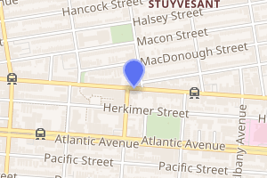
| Address | Fulton Street, Brooklyn and Tompkins Avenues, Brooklyn, NY 11213 | ||||||||||||||||||||||||||||
| Borough | Brooklyn | ||||||||||||||||||||||||||||
| Locale | Bedford-Stuyvesant | ||||||||||||||||||||||||||||
| Coordinates | 40.680068°N 73.943691°W | ||||||||||||||||||||||||||||
| Division | B (BMT) | ||||||||||||||||||||||||||||
| Line | BMT Fulton Street Line | ||||||||||||||||||||||||||||
| Services | None | ||||||||||||||||||||||||||||
| Transit connections | Tompkins Avenue Line | ||||||||||||||||||||||||||||
| Structure | Elevated | ||||||||||||||||||||||||||||
| Platforms | 2 side platforms | ||||||||||||||||||||||||||||
| Tracks | 2 | ||||||||||||||||||||||||||||
| Other information | |||||||||||||||||||||||||||||
| Opened | May 30, 1888 | ||||||||||||||||||||||||||||
| Closed | May 31, 1940 | ||||||||||||||||||||||||||||
| Station succession | |||||||||||||||||||||||||||||
| Next west | Nostrand Avenue | ||||||||||||||||||||||||||||
| Next east | Albany Avenue (originally) Troy Avenue (replacement) | ||||||||||||||||||||||||||||
| |||||||||||||||||||||||||||||
| |||||||||||||||||||||||||||||
| |||||||||||||||||||||||||||||


References
- "Fulton Street El". StationReporter.net. Archived from the original on 2013-04-08.
- 1912 BRT Map
- 1924 BMT map
- "Two Subway Links Start Wednesday". The New York Times. April 6, 1936. p. 23. Retrieved October 7, 2011.
- "NEW SUBWAY LINK OPENED BY MAYOR; He Tells 15,000 in Brooklyn It Will Be Extended to Queens When Red Tape Is Cut". The New York Times. April 9, 1936. ISSN 0362-4331. Retrieved August 15, 2016.
- "Fulton Street 'L' Was Last Word In Progreess at '88 opening". Brooklyn Daily Eagle. May 31, 1940. Retrieved February 19, 2016 – via Newspapers.com.