Borigumma
Borigumma is a town in Koraput district of Odisha state of India.
Borigumma | |
|---|---|
town | |
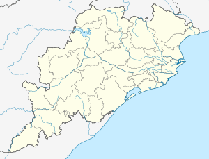 Borigumma Location in Odisha, India  Borigumma Borigumma (India) | |
| Coordinates: 19°2′52″N 82°33′13″E | |
| Country | |
| State | Odisha |
| District | Koraput |
| Elevation | 588 m (1,929 ft) |
| Languages | |
| • Official | Oriya |
| Time zone | UTC+5:30 (IST) |
| PIN | 764056 |
| Telephone code | 06860 |
| Vehicle registration | OR- |
| Coastline | 0 kilometres (0 mi) |
| Nearest city | Jeypore |
| Climate | Aw (Köppen) |
| Website | odisha |
Geography
It is located at .[1]
Demographics
The population of the Borigumma is above 20000.
Location
National Highway 26 and National Highway 201 passes through it. Borigumma is a Junction for the Three Towns Jeypore, Nabarangpur and Kotpad.
Administration
Borigumma is the largest block of Odisha. It is also called land of Bhairaba. In Borigumma Block, there are 30 Grama Panchayats at present. Borigumma is in Koraput District.
According to local residence L.N.Patnaik the name Borigumma derived from two local words "Bori" means a fruit (boro koli) and "Gumma" means high land. According to local old people there used to be a tall boro koli tree in the center of town. The Bhairab Temple at Bhairabsingpur village of Borigumma is a protected monument.[2] Other temples in the area are the Jagannath Temple in the East, the Manikeswari Temple in the South, the Santoshimata Temple in the North, Hanuman Temple, Sriram Temple, Nilakantheswar Temple, Pataleswor Temple, Nilamadhab Temple, Meria Temple, Trinath Temple and Buddha Bhairab Temple.
Local festivals
The major festivals observed in Borigumma are Magha Mandei and Bali Yatra festival. Magha Mandei is observed in the month of February where as Bali Yatra festival is observed in every three years interval .
References
- http://wikimapia.org/925577/Borigumma-the-Land-of-Bhairaba Wikimapia
- http://www.newindpress.com/NewsItems.asp?ID=IEQ20060505010504&Page=Q&Title=OR%5B%5D ISSA&Topic=0 Article on the Bhairab Temple