Becca di Luseney
Becca di Luseney (French: Pic de Luseney) (3,502m) is a mountain of the Pennine Alps in Aosta Valley, northwest Italy. It has a pyramidal look on all four sides, and its north face is covered with a glacier. A huge rockfall from its southwest face came down in 1952, completely destroying the village of Chamen and other settlements in the Valpelline valley. The mountain was first climbed in 1866.[2]
| Becca di Luseney | |
|---|---|
| Pic de Luseney | |
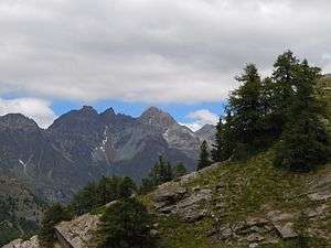 The Becca di Luseney summit (third mountain from left) | |
| Highest point | |
| Elevation | 3,504 m (11,496 ft) |
| Prominence | 646 m (2,119 ft) [1] |
| Coordinates | 45°52′13″N 7°29′27″E |
| Geography | |
 Becca di Luseney Location in the Alps | |
| Location | Aosta Valley, Italy |
| Parent range | Pennine Alps |
| Climbing | |
| First ascent | 1866 |
References
- "Becca di Luseney, Italy". Peakbagger.com. Retrieved 10 February 2015.
- "Becca di Luseney - summitpost". summitpost.org. Retrieved 10 February 2015.
This article is issued from Wikipedia. The text is licensed under Creative Commons - Attribution - Sharealike. Additional terms may apply for the media files.