Panjgur
Panjgur or Panggur (Balochi and Urdu: پنجگور), with the older name Bannajbur[1] and Fannazbur[2] is a small town in Panjgur District, Balochistan. It is known for growing dates and accounts for more than 50 percent of dates produced in Pakistan.
Panjgur پنجگور Bannajbur[1] | |
|---|---|
District Headquarters | |
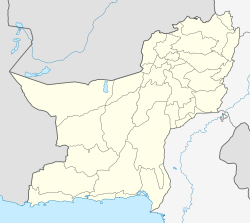 Panjgur  Panjgur | |
| Coordinates: 26°58′6″N 64°6′5″E | |
| Country | Pakistan |
| Province | Balochistan Province |
| District | Panjgur District |
| Elevation | 980 m (3,220 ft) |
| Time zone | UTC+5 (PST) |
History
Al-Muqaddasī (985 AD) documented that Bannajbur was the capital of Makran and that it was populated by people called Balūṣī (Baluchi). This is the first known reference to the Baloch people.[3]:568
Climate
Panjgur has a hot desert climate (Köppen climate classification BWh) with very hot summers and mild winters. Precipitation mainly falls in two distinct periods: in the late winter and early spring from February to April, and in the monsoon in June and July.
| Climate data for Panjgur | |||||||||||||
|---|---|---|---|---|---|---|---|---|---|---|---|---|---|
| Month | Jan | Feb | Mar | Apr | May | Jun | Jul | Aug | Sep | Oct | Nov | Dec | Year |
| Record high °C (°F) | 26.7 (80.1) |
29.4 (84.9) |
34.5 (94.1) |
39.0 (102.2) |
44.4 (111.9) |
45.0 (113.0) |
45.0 (113.0) |
43.3 (109.9) |
41.5 (106.7) |
38.0 (100.4) |
34.0 (93.2) |
29.0 (84.2) |
45.0 (113.0) |
| Average high °C (°F) | 17.4 (63.3) |
19.8 (67.6) |
25.6 (78.1) |
31.2 (88.2) |
36.3 (97.3) |
39.4 (102.9) |
38.8 (101.8) |
38.1 (100.6) |
35.4 (95.7) |
30.7 (87.3) |
24.8 (76.6) |
19.5 (67.1) |
29.8 (85.5) |
| Daily mean °C (°F) | 10.5 (50.9) |
12.8 (55.0) |
18.2 (64.8) |
23.7 (74.7) |
28.5 (83.3) |
31.7 (89.1) |
31.7 (89.1) |
30.7 (87.3) |
27.2 (81.0) |
22.1 (71.8) |
16.6 (61.9) |
12.1 (53.8) |
22.1 (71.9) |
| Average low °C (°F) | 3.7 (38.7) |
5.7 (42.3) |
10.9 (51.6) |
16.1 (61.0) |
20.7 (69.3) |
24.0 (75.2) |
24.7 (76.5) |
23.3 (73.9) |
19.0 (66.2) |
13.6 (56.5) |
8.4 (47.1) |
4.6 (40.3) |
14.6 (58.2) |
| Record low °C (°F) | −6.7 (19.9) |
−4.4 (24.1) |
0.0 (32.0) |
5.0 (41.0) |
5.5 (41.9) |
13.5 (56.3) |
13.9 (57.0) |
13.9 (57.0) |
8.9 (48.0) |
3.0 (37.4) |
−3.3 (26.1) |
−7.8 (18.0) |
−7.8 (18.0) |
| Average precipitation mm (inches) | 16.3 (0.64) |
16.2 (0.64) |
15.6 (0.61) |
7.4 (0.29) |
3.1 (0.12) |
3.3 (0.13) |
25.0 (0.98) |
9.2 (0.36) |
1.5 (0.06) |
0.8 (0.03) |
0.8 (0.03) |
9.5 (0.37) |
108.7 (4.26) |
| Source: NOAA (1961-1990) [4] | |||||||||||||
Subdivisions
The three main subdivisions of Panjgur are Gramkān, Qila Khudābadān and Tasp. Tasp is mostly populated by the Mullazai tribe
See also
References
- Bosworth, Clifford Edmund (January 1977). The Medieval History of Iran, Afghanistan, and Central Asia. Variorum Reprints. p. 128. ISBN 9780860780007. Retrieved 22 April 2017.
- Verma, Harish Chandra (April 13, 1986). Dynamics of Urban Life in Pre-Mughal India. Munshiram Manoharlal. ISBN 9788121500012 – via Google Books.
- Hansman, John (1973), "A Periplus of Magan and Meluhha", Bulletin of the School of Oriental and African Studies, 36 (3): 553–587, doi:10.1017/S0041977X00119858, JSTOR 613582
- "Panjgur Climate Normals 1961-1990". National Oceanic and Atmospheric Administration. Retrieved January 17, 2013.