Balne
Balne is a village and civil parish in the Selby District of North Yorkshire in England, south of Selby. According to the 2001 census the parish had a population of 231,[2] reducing to 224 at the 2011 census.[1] The parish is bound to the north-east by the East Riding of Yorkshire and to the south by the Metropolitan Borough of Doncaster in South Yorkshire.
| Balne | |
|---|---|
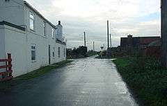 The crossroads, Balne | |
 Balne Location within North Yorkshire | |
| Population | 224 (2011 census)[1] |
| OS grid reference | SE587190 |
| District | |
| Shire county | |
| Region | |
| Country | England |
| Sovereign state | United Kingdom |
| Post town | GOOLE |
| Postcode district | DN14 |
| Police | North Yorkshire |
| Fire | North Yorkshire |
| Ambulance | Yorkshire |
| UK Parliament |
|
The village formed the centre of the ancient district of Balne, which consisted of the eastern part of the Osgoldcross wapentake, probably including all the land between the River Don and the River Aire. Places such as Walden Stubbs and Fishlake were formerly described as being "-in-Balne", and Thorpe-in-Balne still is. Balne Croft Common near Thorne may have been a detached part of the township of Balne.[3]
The village has a Grade II Listed Building called Lowgate Farmhouse.[4] Until 1958, Balne had a railway station as part of the North Eastern Railway.[5]
References
- UK Census (2011). "Local Area Report – Balne Parish (E04007712)". Nomis. Office for National Statistics. Retrieved 28 June 2019.
- UK Census (2001). "Local Area Report – Balne Parish (36UH006)". Nomis. Office for National Statistics. Retrieved 28 June 2019.
- Hey, David (2003). Medieval South Yorkshire. Landmark Publishing Ltd. ISBN 1843060809.
- "Lowgate Farmhouse, Balne, North Yorkshire". Retrieved 30 March 2020.
- Historic England. "Balne (501315)". PastScape. Retrieved 30 March 2020.
External links
![]()