Bald Peak
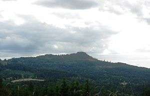
Bald Peak is a mountain top and highest point in the Chehalem Mountains in the Northwest area of the U.S. state of Oregon. Located in Yamhill County near the county line with Washington County, the summit at 1624+ feet (495+ m) is the highest point in the Willamette Valley. Bald Peak State Scenic Viewpoint is a 26-acre (11 ha) state park located on the peak.
| Bald Peak | |
|---|---|
 | |
| Highest point | |
| Elevation | 1624+ ft (495+ m) NAVD 88[1] |
| Prominence | 1,400 feet (427 m) [1] |
| Coordinates | 45°23′45″N 123°03′22″W [2] |
| Geography | |
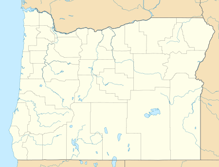 Bald Peak Location in Oregon | |
| Location | Yamhill County, Oregon, U.S. |
| Parent range | Chehalem Mountains |
| Topo map | USGS Laurelwood |
Geology
The mountain range that includes the peak is composed of a single land mass that was uplifted by tectonics.[3] Bald Peak is both the highest part of the range and the highest point within the Willamette Valley.[3]
References
- "Bald Peak, Oregon". Peakbagger.com. Retrieved 2014-02-10.
- "Bald Peak". Geographic Names Information System. United States Geological Survey. Retrieved 2015-01-17.
- "Chehalem Mountains now official wine area". Portland Business Journal. December 27, 2006.
External links
- Image from the peak. Oregon State Archives: Oregon Scenic Images of Yamhill County.
This article is issued from Wikipedia. The text is licensed under Creative Commons - Attribution - Sharealike. Additional terms may apply for the media files.