Aghireșu
Aghireșu (Hungarian: Egeres; German: Erldorf) is a commune in Cluj County, Transylvania, Romania.
Aghireșu Egeres | |
|---|---|
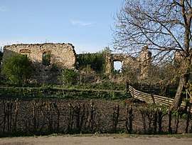 Ruins of Aghireșu castle | |
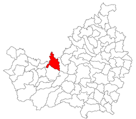 Location in Cluj County | |
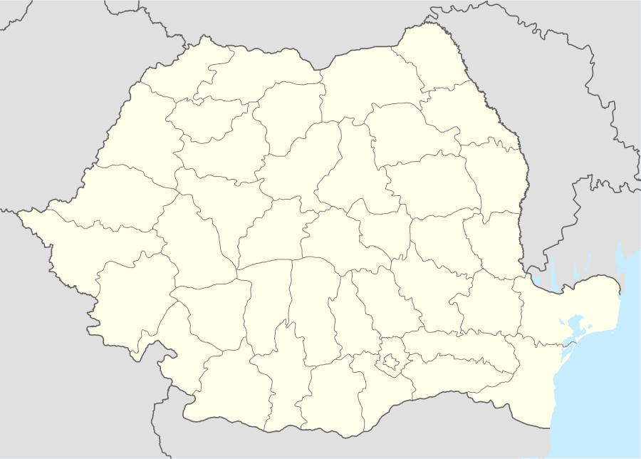 Aghireșu Location in Romania | |
| Coordinates: 46°52′21″N 23°14′30″E | |
| Country | |
| County | Cluj |
| Established | 1263 |
| Subdivisions | Aghireșu, Aghireșu-Fabrici, Arghișu, Băgara, Dâncu, Dorolțu, Inucu, Leghia, Macău, Ticu, Ticu-Colonie |
| Government | |
| • Mayor | Lehene Sorin Gelu (PSD) |
| Area | 105.79 km2 (40.85 sq mi) |
| Elevation | 447 m (1,467 ft) |
| Population (2011)[1] | 7,116 |
| • Density | 67/km2 (170/sq mi) |
| Time zone | EET/EEST (UTC+2/+3) |
| Postal code | 407005 |
| Area code | +40 x64[2] |
| Vehicle reg. | CJ |
| Website | www |
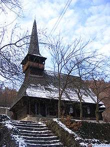
Tămaşa wooden church, now located in Ticu-Colonie
The commune has an area of 105.79 km2 and a population of 7156 people (2007). It is composed of eleven villages: Aghireșu, Aghireșu-Fabrici (Egeres-gyártelep), Arghișu (Argyas), Băgara (Bogártelke), Dâncu (Dank), Dorolțu (Nádasdaróc), Inucu (Inaktelke), Leghia (Jegenye), Macău (Mákófalva), Ticu (Forgácskút) and Ticu-Colonie (Ferencbánya).
Demographics
According to the 2011 census, Romanians made up 51.9% of the population, Hungarians made up 36.7% and Roma made up 8.0%.[3]
Notes
- "Populaţia stabilă pe judeţe, municipii, oraşe şi localităti componenete la RPL_2011" (in Romanian). National Institute of Statistics. Retrieved 4 February 2014.
- x is a digit indicating the operator: 2 for the former national operator, Romtelecom, and 3 for the other ground telephone networks
- Tab8. Populaţia stabilă după etnie – judeţe, municipii, oraşe, comune, 2011 census results, Institutul Național de Statistică, accessed 17 February 2020.
References
- Atlasul localităților județului Cluj (Cluj County Localities Atlas), Suncart Publishing House, Cluj-Napoca, ISBN 973-86430-0-7
External links
![]()
- (in Romanian and Hungarian) Administrative map of the county

This article is issued from Wikipedia. The text is licensed under Creative Commons - Attribution - Sharealike. Additional terms may apply for the media files.