Balé Province
Balé is one of the 45 provinces of Burkina Faso, located in its Boucle du Mouhoun Region with Boromo as capital. Its area is 4,595 km2 (1,774 sq mi), and in 2006 had a population of 213,897. The province is known for its Deux Balé Forest, populated by savannah elephant herds. Boromo, the provincial capital, is located on the main road from Ouagadougou to Bobo-Dioulasso. In June 2007, the Canadian mining company, Semafo, open the third gold mine in the country in Mana in the province, with an investment of about $116 million.
Balé | |
|---|---|
Province | |
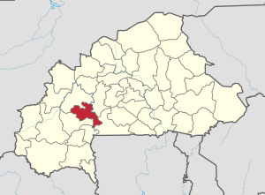 Location in Burkina Faso | |
 Provincial map of its departments | |
| Country | |
| Region | Boucle du Mouhoun |
| Capital | Boromo |
| Area | |
| • Total | 4,596 km2 (1,775 sq mi) |
| Population (2006) | |
| • Total | 213,897 |
| • Density | 47/km2 (120/sq mi) |
| Time zone | UTC+0 (GMT 0) |
History
On November 15, 2008 a bus accident killed 69 people at Boromo.[1] when a passenger bus transporting workers to Côte d'Ivoire collided with a commercial truck. Both vehicles burst into flames.[2]
Geography
The province is known for its Deux Balé Forest, populated by savannah elephant herds.[3] Boromo, the provincial capital, is located on the main road from Ouagadougou to Bobo-Dioulasso,[4] and serves as a gateway to the park.[5]
Demographics
Most people in the province live in rural areas; 199,012 Burkinabé live in the countryside with only 14,885 people residing in urban areas. There are 105,853 men living in Balé Province and 108,044 women.[6]
Departments
Bale is divided into 10 departments:
| Department | Capital city | Population (Census 2006)[6] |
|---|---|---|
| Bagassi Department | Bagassi | 33,130 |
| Bana Department | Bana | 12,999 |
| Boromo Department | Boromo | 30,305 |
| Fara Department | Fara | 37,194 |
| Oury Department | Oury | 26,892 |
| Pâ Department | Pa | 19,675 |
| Pompoi Department | Pompoi | 11,060 |
| Poura Department | Poura | 12,075 |
| Siby Department | Siby | 14,143 |
| Yaho Department | Yaho | 16,424 |
Economy and services
In June 2007, the Canadian mining company, Semafo, open the third gold mine in the country in Mana, with an investment of about $116 million.[7] There is a hydroelectric station at Boromo, operated by the Société Nationale d'électricité du Burkina Faso (SONABEL) with 1,269 MWh.[8][9]
In 2011 the province had 164 primary schools and 22 secondary schools.[10]
In 2011 the province had 31 health and social promotion centers (Centres de santé et de promotion sociale), 4 doctors and 115 nurses.[10]
See also
- Regions of Burkina Faso
- Provinces of Burkina Faso
- Communes of Burkina Faso
References
- Rupley, Lawrence; Bangali, Lamissa; Diamitani, Boureima (2013). Historical Dictionary of Burkina Faso. Rowman & Littlefield. p. 72. ISBN 978-0-8108-6770-3.
- Encyclopædia Britannica Almanac 2010. Encyclopædia Britannica, Inc. 1 January 2010. p. 33. ISBN 978-1-61535-329-3.
- "Program "My Elephant Neighbor" Final Report – June 2011" (PDF). Elephantconservation.org. Retrieved 16 October 2016.
- Google Maps. Retrieved 16 October 2016.
- Ham, Anthony (2009). West Africa. Lonely Planet. p. 147. ISBN 978-1-74104-821-6.
- "2006 census" (PDF). Archived from the original (PDF) on 24 November 2007. Retrieved 16 October 2016.
- West Africa Development and Business Opportunities Handbook Volume 1. IBP, Inc. 7 February 2007. p. 74. ISBN 978-1-4330-5912-4.
- Obuobie, Marloes Mul, Emmanuel; Appoh, Richard; Yeboah, Kwabena Kankam- (1 February 2015). Water Resources Assessment of the Volta River Basin. IWMI. p. 39. ISBN 978-92-9090-829-6.
- "Boromo". CARMA. Retrieved 16 October 2016.
- "La région du Boucle du Mouhoun en chiffres" (PDF). Institut National de la Statistique et de la Démographie (INSD). 2011. p. 6. Archived from the original (PDF) on 13 November 2012.
| Authority control |
|---|