Highways in Hungary
Controlled-access highways in Hungary are dual carriageways, grade separated with controlled-access, designed for high speeds. The legislation amendments defined two types of highways: motorways (Hungarian: autópálya) and expressways (Hungarian: autóút).

The main differences are that motorways have emergency lanes and the maximum allowed speed limit is 130 km/h (81 mph), while expressways may be built without them and the speed limit is 110 km/h (68 mph).
According to the Állami Autópályakezelő Zrt. ("State Motorway Management Plc."), the total length of the Hungarian motorway system was 1,491 kilometers in 2018.[1] The construction of the Hungarian motorway system started in 1964 with M7, which finished in 1975 between Budapest and the Lake Balaton. The total length of the system reached 200 km in 1980, 500 km in 1998 and 1000 km in 2007.
The Hungarian motorway network currently comprises 13 motorways, 13 expressways, and some fast roads (R), of which 20 of them are at least partially operational, and 10 (M1, M5, M7, M15, M19, M31, M35, M43, M51 and M70) have been completed by the end of 2019.
Highway system
Motorways
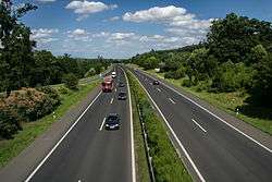
The motorways in Hungary, Hungarian: autópálya (abbr. M), are defined as two-lane motorways in each direction, with emergency lane. The speed limit is 130 km/h or 80 mph. Their road signs are white on blue.
| Designation | Route | Length (2019) | |||
|---|---|---|---|---|---|
| Number | E-road | Planned | In service | Status (% in use) | |
| Budapest - Tatabánya - Győr - Mosonmagyaróvár – Border with Austria |
171 km | 171 km | Completed (100%) | ||
E579 |
Budapest - Hatvan - Füzesabony - Polgár - Nyíregyháza - Vásárosnamény – Border with Ukraine near Beregdaróc | 307 km | 280 km | Planned (91.2%) | |
| Budapest - Szolnok - Püspökladány - Berettyóújfalu – Border with Romania |
233 km | 66 km UC: 49 km |
Under construction (29%) | ||
| Budapest - Kecskemét - Szeged – Border with Serbia |
173 km | 173 km | Completed (100%) | ||
| Budapest ( |
212 km | 193 km | Planned (91%) | ||
| Budapest - Székesfehérvár - Siófok - Nagykanizsa – Border with Croatia |
233 km | 233 km | Completed (100%) | ||
| Szolnok ( |
330 km | 35 km UC: 28,9 km |
Under construction (10.6%) | ||
| Via Carpathia: Emőd ( |
95 km | 28 km UC: 56,8 km |
Under construction (29.5%) | ||
| Nagytarcsa ( |
12 km | 12 km | Completed (100%) | ||
| Görbeháza ( |
68,8 km | 68,8 km | Completed (100%) | ||
| Szeged ( |
57,7 km | 57,7 km | Completed (100%) | ||
| Bóly ( |
56 km | 32 km | Planned (53.6%) | ||
M1

The M1 starts from the western part of Budapest, it connects the Hungarian capital with Győr and northwestern part of Hungary, towards Vienna. The motorway is part of the Pan-European Corridor IV, and European route E60, E65 and E75. Average daily traffic is 75,510 near Budapest and 56,421 vehicles/day near Győr.[2] The construction of the motorway began 1964, it took more than thirty years to reach Hegyeshalom and the Austrian border. Its significance has increased since the change of regime in 1990, and today it is the most important western connection in Hungary.
Main junctions:

M3
The M3 starts from north-eastern part of Budapest, it connects the Hungarian capital with Nyíregyháza and northeast part of Hungary, towards Mukachevo. The motorway is part of the Venice-Trieste-Ljubljana-Budapest-Lviv-Kiev line Central-East Europe Corridor V, and European route E71, E79, E573 and E579. This is one of the most important route of the Hungarian motorway and road network, the southwest-north-eastern diagonal main line of traffic forming part of Budapest. Through Ukraine, Eastern Europe, and through Slovakia, creates a highway connection to the countries of north-eastern Europe.
Main junctions:
M5
The M5 starts from Budapest, it connects the Hungarian capital with Szeged and southeast part of Hungary, towards Belgrade. It was the third motorway in Hungary that reached the border. The motorway is part of the Pan-European Corridor X, and European route E75. The motorway was built in the 1980s and reached the Serbian border in March 2006.
Main junctions:
M6
The M6 starts from Budapest (M0-M6 Interchange), it connects the Hungarian capital with Mohács, on the right bank of the Danube in the south, towards Osijek and Sarajevo. The motorway is part of the European route E73. The motorway is planned to reach the Croatian border by 2022.
Main junctions:
M7
The M1 starts from western part of Budapest, it connects the Hungarian capital with Lake Balaton and southwestern part of Hungary, towards Zagreb. The motorway is part of the Pan-European Corridor V, and European route E71. Average daily traffic is 62,779 near Budapest and 49,273 vehicles/day near Székesfehérvár.[2] The motorway was built in the 1960s and reached the Croatian border in October 2008.
Main junctions:
 Pentele Bridge in M8
.jpg) M15 near Rajka
M15 near Rajka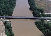 Sajó Bridge in M30
 M35 near Derecske
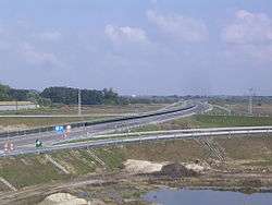 M43 near Szeged-Sándorfalva
 M60 near Kozármisleny
Expressways
The expressways in Hungary, Hungarian: autóút (abbr. M as well) are defined as dual carriageways with lower standards than that of a motorway, but with the same restrictions. The speed limit is 110 km/h or 70 mph. Their road signs are white on blue.
| Number | Route | Length (2019) | ||
|---|---|---|---|---|
| Planned | In service | Status | ||
| Budapest bypass | ~ 108 km | 77 km | Planned (71,3%) | |
| Budapest ( |
70 km | 32 km | Planned (45,7%) | |
| Szombathely ( |
~ 300 km | 21 km | Planned (7%) | |
| Budapest - Pilisvörösvár – Border with Slovakia near Esztergom | 34 km | 0 km | Planned (0%) | |
| Mosonmagyaróvár ( |
15 km | 15 km | Completed (100%) | |
| Győr ( |
10 km | 10 km | Completed (100%) | |
| Füzesabony ( |
18,5 km | 4 km UC: 14.5 km |
Under construction (21,6%) | |
| Vásárosnamény ( |
39 km | 0 km | Planned (0%) | |
| Kecskemét ( |
111 km | 62 km UC: 19 km |
Under construction (56%) | |
| Part of old ring of Budapest | 9 km | 9 km | Completed (100%) | |
| Letenye ( |
21 km | 21 km | Completed (100%) | |
| Balatonszentgyörgy ( |
32,6 km | 0 km UC: 8,6 km |
Under construction (0%) | |
| Győr (M1) - Csorna – Border with Austria |
95 km | 31,6 km UC: 57,9 km |
Under construction (33,2%) | |
| Szombathely - Csorna - Mosonmagyaróvár ( |
115 km | 71 km | Planned (61,7%) | |
| Szombathely ( |
20 km | 0 km | Planned (0%) |
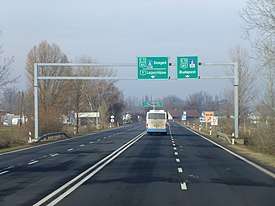
 Eastern section of M0
 M2 near Vác
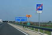 The end of M9 near Dusnok
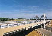 Korongi Bridge in M70
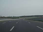 M85-M86 near Csorna
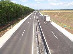 M86 near Szombathely
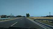 R21 near Zagyvaszántó.
Fast roads
The fast roads in Hungary, Hungarian: gyorsút (abbr. R) are defined as dual carriageways with lower standards than that of an expressway, but the level intersection (e.g., traffic light node, roundabout) is permissible. The speed limit is also 110 km/h or 70 mph. (Fast road category was ceased in 2018, these roads will become main roads.)
| Number | Route | Length |
|---|---|---|
| ? km Existing: 0 km | ||
| 45 km Existing: 0 km | ||
| 46 km Existing: 0 km | ||
| Győr (M1) - Pápa | 36 km Existing: 0 km |
- 2x2 traffic lanes main roads
- Road
_Otszogletu_zold_tabla.svg.png)
- Several parts of Road
_Otszogletu_zold_tabla.svg.png)
- Road
_Otszogletu_zold_tabla.svg.png)
- Road
_Otszogletu_zold_tabla.svg.png)
- Several parts of Road
_Otszogletu_zold_tabla.svg.png)
- In the future this sections will be part of M8.
- Road
_Otszogletu_zold_tabla.svg.png)
- Several parts of Road
_Otszogletu_zold_tabla.svg.png)
- In the future this sections will be part of R21.
- Road
_Otszogletu_zold_tabla.svg.png)
- Road
_Otszogletu_zold_tabla.svg.png)
- Road
_Otszogletu_zold_tabla.svg.png)
- Road
_Otszogletu_zold_tabla.svg.png)
- Road
_Otszogletu_zold_tabla.svg.png)
Toll requirements

The e-vignette user charge system applies to motorcycles, passenger cars and their trailers, as well as cargo vehicles with a maximum permissible gross weight of 3.5 tonnes, campers and buses, and their trailers. These vehicles are authorized to use the Hungarian toll speedway network's roads exclusively with pre-purchased –purchased prior to entering a toll speedway section– road use authorization, i.e. e-vignettes. The amount of toll charges depends on the category of the vehicle and the type of the e-vignette. The category of the motor vehicles must be determined according to the official entry that appears in the vehicle registration certificate, based on the maximum permissible gross weight of the motor vehicle and the number of persons it is allowed to transport.[3]
Hungarian system has 2 main type in terms of salary.
1, time-based fee vignettes (E-matrica) with a validity of either 10 days (2975 HUF), 1 month (4780 HUF) or 1 year (42980 HUF). The following motorway sections are toll-free for cars up to 3.5 t:[4]
- the following sections of the M0 expressway: - 63 km
- the section between Main Road 1 (exit -1) and the M5 motorway (exit 32),
- the section between M4 expressway (exit 41) and M3 motorway (exit 68),
- Megyeri Bridge (the section between Main Road 11 and Main Road 2), (exit 74-77).
- the M31 motorway - 12 km
- the section of M4 expressway (sign of Main Road 4) between the road leading from Vecsés to Budapest Liszt Ferenc International Airport (section between km section 19+550 and km section 20+518)
- the M8 motorway
- the Pécs south-west loop section of the M60 motorway between roads no. 58 (exit 30) and 5826 (exit 32) - 2 km
- 2, regional vignettes
History
Development of the overall length (at the end of):
| Year | 1964 | 1970 | 1975 | 1980 | 1985 | 1990 | 1996 | 2002 | 2006 | 2010 | 2014 | 2016 | 2017 | 2018 | 2019 | 2020 |
| Length in km | 7 | 85 | 136 | 213 | 302 | 361 | 440 | 638 | 967 | 1,290 | 1,382 | 1,481 | 1,489 | 1,524 | 1,600 | 1,630 (now) |
| Year | Length (km) | Year | Length (km) | Year | Length (km) | ||
|---|---|---|---|---|---|---|---|
| 1964 | 7 | 2003 | 667 | 2013 | 1,361 | ||
| 1970 | 85 | 2004 | 717 | 2014 | 1,370 | ||
| 1975 | 136 | 2005 | 803 | 2015 | 1,447 | ||
| 1980 | 213 | 2006 | 967 | 2016 | 1,481 | ||
| 1985 | 302 | 2007 | 1,037 | 2017 | 1,490 | ||
| 1990 | 361 | 2008 | 1,113 | 2018 | 1,524 | ||
| 1996 | 440 | 2009 | 1,118 | 2019 | 1,600 | ||
| 2001 | 571 | 2010 | 1,290 | 2020 | 1,630 (now) | ||
| 2002 | 638 | 2011 | 1,321 | ||||
| IEA-PVPS,[5] | |||||||
Hungarian highways network since 1964


Opening of new motorways
Construction of new motorways in recent years has been hampered due to corruption scandals and austerity measures as well as owing to new European rules under which old EIA assessments lapsed. In the coming years, the highway network will be expanded first of all near Budapest and border region of Hungary. Construction of non-radial roads continues to be slow.
| Highway | From | To | Length | Construction started | Due to open | Remarks | |
|---|---|---|---|---|---|---|---|
| Debrecen (main road 4) | junction with main road 481 | 5.43 km | 07/2016 | 12/2017[7] | OPEN | ||
| Csorna | Farád | 4.45 km | 04/2016 | 04/2018[8] | bypass of Csorna (II. phase) OPEN | ||
| junction with main road 483 | Berettyóújfalu (M4) | 18.7 km | 07/2016 | 12/2018[9] | last section of M35
OPEN | ||
| Berettyóújfalu (M35) | junction with main road 47 | 2.95 km | 11/2016 | 12/2018[10] | OPEN | ||
| Andornaktálya | Eger | 4 km | 11/2018[11] | OPEN | |||
| Nagykőrös | Tiszakürt | 31.0 km | 07/2018 | 08/2021[12] | 2nd carriageway | ||
| Tiszakürt | Kondoros | 62.0 km | 12/2016 | 10/2/2019[13] | OPEN | ||
| Kondoros | Békéscsaba | 17.6 km | 03/2018 | 1st Q. 2021[14] | 2nd carriageway | ||
| Üllő | Albertirsa | 30.0 km | 01/2017 | 1st Q. 2020[15] | OPEN | ||
| Albertirsa | Cegléd | 14.4 km | 01/2017 | 1st Q. 2020[16] | 2nd carriageway | ||
| Budapest | Vác | 19.6 km | 04/2017 | 09/30/2019[17] | 2nd carriageway | ||
| Andornaktálya | junction with M3 motorway | 14.6 km | 01/2018 | 06/2020[18] | 2nd carriageway | ||
| Miskolc | Tornyosnémeti | 56.75 km | 03/2018 | 3rd Q. 2021[19] | |||
| Csorna | Fertőrákos | 57,45 km | 03/2018 | 4th Q. 2020[20] | 2nd carriageway | ||
| Fenékpuszta | M7 motorway | 8,6 km | 02/2018 | 2nd Q. 2020[21] | 2nd carriageway | ||
| junction with M7 motorway | Kaposvár | 33.2 km | 06/2017 | 09/2019[22] | |||
| junction with main road 47 | border of Romania | 26.5 km | 05/2017 | 01/2020[23] | |||
| junction with M1 motorway | border of Slovakia | 14.5 km | 02/2018 | 12/2019[24] | OPEN | ||
| Letenye | border of Slovenia | 13.7 km | 11/2017 | 12/2019[25] | second lane of motorway | ||
| Körmend | border of Austria | 29 km | 12/2017 | 2/2021[26] | single carriageway |
See also
References
- Állami Autópályakezelő Zrt. (ÁAK) (2013). "Az ÁAK által kezelt úthálózat részletes adatai (2013)". Nemzetiutdij.hu. Archived from the original on 2015-03-23. Retrieved 2015-05-14.
- "Az autópálya-hálózat forgalmi menedzsment tervének elõkészítõ vizsgálatai – forgalmi elemzések" (PDF) (in Hungarian). ktenet.hu.
- "National Toll Payment Services PLC". toll-charge.hu.
- "National Toll Payment Services PLC". toll-charge.hu.
- http://www.irena.org/DocumentDownloads/Publications/IRENA_RE_Capacity_Statistics_2017.pdf
- This list contains the limited-access roads (expressways) in Hungary with (at least) four traffic lanes and median.
- "Már autózhatunk az M35-ös sztráda új szakaszán és a debreceni déli elkerülő úton". dehir.hu. Retrieved 2017-12-13.
- "Sopron megközelítése, M85 autóút Csorna elkerülő (II. ütem) megvalósítása". Nif.hu. Retrieved 2017-07-15.
- "M35 autópálya (II. ütem) 481. sz. főút – Berettyóújfalu közötti szakasz megvalósítása". Nif.hu. Retrieved 2017-07-15.
- "M4 autópálya Berettyóújfalu – Nagykereki országhatár közötti szakasz megvalósítása I. ütem". Nif.hu. Retrieved 2017-07-15.
- "Átadták a forgalomnak az M25 autóút északi ütemét". Nif.hu. Retrieved 2018-11-07.
- "Békéscsaba megközelítése, M44 Nagykőrös – Tiszakürt". Nif.hu. Retrieved 2015-11-10.
- "Békéscsaba megközelítése, M44 Tiszakürt – Kondoros". Nif.hu. Retrieved 2017-07-15.
- "Megkezdődtek a munkálatok az M44 Kondoros-Békéscsaba közötti szakaszán". Nif.hu. Retrieved 2018-03-20.
- "M4 gyorsforgalmi út Üllő-Albertirsa közötti szakasz kivitelezése". Nif.hu. Retrieved 2017-07-15.
- "M4 gyorsforgalmi út Albertirsa-Cegléd közötti szakasz kivitelezése". Nif.hu. Retrieved 2017-07-15.
- "M2 gyorsforgalmi út megvalósítása Budapest-Vác". Nif.hu. Retrieved 2017-07-15.
- "Eger megközelítés M25 Déli ütem megvalósítása (1. építési (déli) szakasz kivitelezése)". Nif.hu. Retrieved 2018-01-23."Eger megközelítés M25 Déli ütem megvalósítása (2. építési (északi) szakasz kivitelezése)". Nif.hu. Retrieved 2016-11-03.
- "ELKEZDŐDIK AZ M30 AUTÓPÁLYA MISKOLC – TORNYOSNÉMETI KÖZÖTTI SZAKASZÁNAK ÉPÍTÉSE". Nif.hu. Retrieved 2018-03-12.
- "Letették az M85 autóút Csorna II. – Sopron-kelet – Fertőrákos csomópont közötti szakasz alapkövét/". Nif.hu. Retrieved 2018-03-12.
- "Letették az M76 gyorsforgalmi út Zalaegerszeg – M7 autópálya közötti szakaszának alapkövét". Nif.hu. Retrieved 2018-02-23.
- "Kaposvár megközelítése, 67. sz. főút Kaposfüred és Látrány elkerülő utak közötti szakasz fejlesztése". Nif.hu. Retrieved 2017-07-15.
- "M4 autópálya Berettyóújfalu – Nagykereki országhatár közötti szakasz II. ütem megvalósítása". Nif.hu. Retrieved 2017-07-15.
- "Átépül az M15 autóút M1 – Rajka országhatár közötti szakasza". Nif.hu. Retrieved 2018-02-08.
- "Megvalósul az M70 autóút Letenye-Tornyiszentmiklós országhatár közötti szakasz 2×2 sávossá bővítése". Nif.hu. Retrieved 2017-11-21.
- "M8 autóút Körmend – Rábafüzes országhatár szakasz 2×1 sávos előkészítése és építése". Nif.hu. Retrieved 2018-03-07.
- General
- Magyarország autóatlasz (Road atlas of Hungary), Dimap-Szarvas, Budapest, 2004
- Magyarország autóatlasz (Road atlas of Hungary), Dimap-Szarvas, Budapest, 2013
External links
| Wikimedia Commons has media related to Motorways in Hungary. |
- National Toll Payment Services Plc (in Hungarian, some information also in English)
- Home page of the National Toll Payment Services Plc.
- Detailed map of the Hungarian motorway system (2015)
| Motorways |  | |
|---|---|---|
| Expressways | ||
| Planned highways |
| |
| History |  | ||||
|---|---|---|---|---|---|
| Geography |
| ||||
| Politics |
| ||||
| Economy | |||||
| Society |
| ||||