Aurlandsfjord
Aurlandsfjord (Norwegian: Aurlandsfjorden, Urban East Norwegian: [ˈæ̂ʉrlɑnsˌfjuːɳ]) is a fjord in Vestland county, Norway. The fjord flows through the municipalities of Aurland, Vik, and Lærdal. The 29-kilometre (18 mi) long fjord is a branch off of the main Sognefjorden, Norway's longest fjord. The fjord is deep and narrow, reaching a depth of about 962 metres (3,156 ft) below sea level, and its width is generally less than 2 kilometres (1.2 mi) wide. About 11 kilometers (6.8 mi) south of the mouth of the fjord, the Nærøyfjord branches off from it to the west. The village of Flåm sits at the innermost part of the Aurlandsfjord; other villages along the fjord are Aurlandsvangen and Undredal. Most of the fjord is surrounded by up to 1,800-metre (5,900 ft) tall, steep mountains with little habitation along the fjord except for in a few small valleys.[1]
| Aurlandsfjord | |
|---|---|
 View of the fjord | |
 Aurlandsfjord Location of the village  Aurlandsfjord Aurlandsfjord (Norway) | |
| Location | Vestland county, Norway |
| Coordinates | 60.9155°N 7.1702°E |
| Primary inflows | Nærøyfjorden |
| Primary outflows | Sognefjorden |
| Basin countries | Norway |
| Max. length | 29 kilometres (18 mi) |
| Average depth | 962 metres (3,156 ft) |
| Settlements | Aurlandsvangen, Flåm |
Large parts of the fjord is included in the Nærøyfjord section of the West Norwegian Fjords UNESCO world heritage site.
Gallery
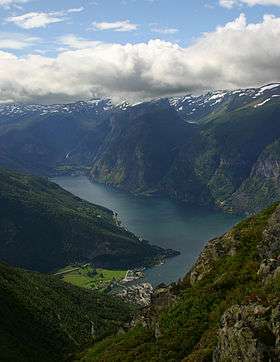
 Aurlandsfjorden as seen from Aurland mountain road
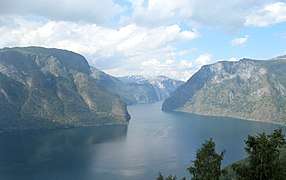 Seen north-northwest from Stegastein
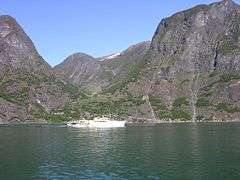 The royal yacht at Skjerdal
 Panorama
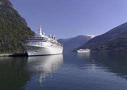 Cruise ship at Flåm
 Undredal seen from boat
References
- Store norske leksikon. "Aurlandsfjorden" (in Norwegian). Retrieved 2014-02-28.