Auquitaipe
Auquitaipe (possibly from Aymara awki father; gentleman, taypi center, middle)[2] is a mountain in the Barroso mountain range in the Andes of Peru, about 5,600 m (18,400 ft) high. It is located in the Tacna Region, Tacna Province, Palca District, and in the Tarata Province, Tarata District. It lies northeast of Coruña.[3]
| Auquitaipe | |
|---|---|
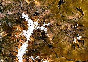 Barroso mountain range (on the left) as seen from space (NASA Landsat). Auquitaipe is visible in the upper part of the range. | |
| Highest point | |
| Elevation | 5,600 m (18,400 ft) [1] |
| Coordinates | 17°28′58″S 69°50′32″W |
| Geography | |
 Auquitaipe Peru | |
| Location | Peru, Tacna Region |
| Parent range | Andes, Barroso |
References
- escale.minedu.gob.pe - UGEL map of the Tacna Province (Tacna Region)
- Radio San Gabriel, "Instituto Radiofonico de Promoción Aymara" (IRPA) 1993, Republicado por Instituto de las Lenguas y Literaturas Andinas-Amazónicas (ILLLA-A) 2011, Transcripción del Vocabulario de la Lengua Aymara, P. Ludovico Bertonio 1612 (Spanish-Aymara-Aymara-Spanish dictionary)
- escale.minedu.gob.pe - UGEL map of the Tacna Province (Tacna Region)
This article is issued from Wikipedia. The text is licensed under Creative Commons - Attribution - Sharealike. Additional terms may apply for the media files.