Arkansas Highway 296
Highway 296 (AR 296, Ark. 296, and Hwy. 296) is an east–west state highway in Miller County. The route begins at US Highway 59 (US 59) and US 71 in Texarkana (State Line Avenue) and runs east to US 82 in the eastern part of the county. Highway 296 serves as an arterial street in Texarkana west of US 67, but is decidedly rural in its length east of US 67, passing through sparsely populated wooded areas typical of the Arkansas Timberlands. The highway was created on April 24, 1963, but was extended throughout the 1960s and 1970s during a period which Arkansas's state highway system grew greatly. Highway 296 is maintained by the Arkansas State Highway and Transportation Department (AHTD).
| ||||
|---|---|---|---|---|
| Route information | ||||
| Maintained by ArDOT | ||||
| Length | 25.68 mi[1] (41.33 km) | |||
| Existed | April 24, 1963[2]–present | |||
| Major junctions | ||||
| West end | ||||
| East end | ||||
| Location | ||||
| Counties | Miller | |||
| Highway system | ||||
| ||||

Route description
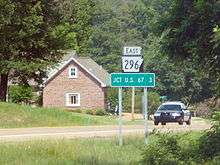
Highway 296 begins at US 59/US 71 in Texarkana (State Line Avenue) just east of the Texas state line. It travels east as Sugar Hill Road through low-density residential area, crossing under Interstate 49 (I-49) and over I-30 without connections to either. Just east of the Texarkana city limits, Highway 296 intersects US 67, beginning a concurrency south.[3]
The pair reenters Texarkana, running south as Broad Street toward the Texarkana Regional Airport. Just north of the airport, Highway 296 ends the overlap with US 67 and turns east with Highway 237. After a short, 0.09 miles (0.14 km) overlap with Highway 237 east as Rondo Lane,[1] Highway 296 turns northeast, following railroad tracks. The highway continues northeast for approximately 1 mile (1.6 km) before running due east as a section line road. Once east of the Texarkana city limits, Highway 296 begins to wind east through the Arkansas Timberlands countryside, roughly following Finn Bayou east to Hervey. Now very near the Red River and the Lafayette county line, the highway turns due south and intersects US 82 four miles (6.4 km) northwest of Garland, where it terminates.[3]
History
Highway 296 was created by the Arkansas State Highway Commission (ASHC) on April 24, 1963 by adopting a county road between US 67 at Mandeville and Hervey to the state highway system.[2] On February 22, 1967, the ASHC authorized the AHTD to prepare plans for construction of an interchange between I-30 and Sugar Hill Road in Texarkana.[4] On February 28, 1968, the ASHC extended Highway 296 to run between US 67 and I-30 as part of a program to connect newly-built Interstate highways with the US highways they paralleled, despite the interchange requested to be studied in 1967 never coming to fruition.[5] The highway was extended west to US 59/US 71 and east to US 82 in accordance with Act 9 of 1973 by the Arkansas General Assembly on June 28, 1973.[6] The act directed county judges and legislators to designate up to 12 miles (19 km) of county roads as state highways in each county.[7]
Major intersections
Mile markers reset at some concurrencies. The entire route is in Miller County.
| Location | mi[1] | km | Destinations | Notes | |||
|---|---|---|---|---|---|---|---|
| Texarkana | 0.00 | 0.00 | Western terminus | ||||
| | 4.64 | 7.47 | Begin US 67 overlap | ||||
| See US 67 and AR 237 | |||||||
| Texarkana | 0.00 | 0.00 | End AR 237 overlap | ||||
| | 21.04 | 33.86 | Eastern terminus | ||||
1.000 mi = 1.609 km; 1.000 km = 0.621 mi
| |||||||
See also


References
- System Information and Research Division (2014). "Arkansas Road Log Database" (MDB). Arkansas State Highway and Transportation Department. Retrieved March 27, 2016.
- "Minutes" (1953–69), p. 916.
- Transportation Planning and Policy Division (February 17, 2015). General Highway Map, Miller County, Arkansas (PDF) (Map). 1:62500. Little Rock: Arkansas State Highway and Transportation Department. Retrieved December 14, 2016.
- "Minutes" (1953–69), p. 279.
- "Minutes" (1953–69), p. 130.
- "Minutes" (1970–79), p. 1194.
- Planning and Research Division, Policy Analysis Section (2010). Development of Highway and Transportation Legislation in Arkansas (PDF). A Review of the Acts Relative to Administering and Financing Highways and Transportation in Arkansas. Little Rock: Arkansas State Highway and Transportation Department. p. 13. Retrieved December 4, 2016.
- "Minutes of the Meeting" (PDF). Arkansas State Highway Commission. 1953–1969. Retrieved December 13, 2016.
- "Minutes of the Meeting" (PDF). Arkansas State Highway Commission. 1970–1979. Retrieved December 13, 2016.
- "Minutes of the Meeting" (PDF). Arkansas State Highway Commission. 2000–2009. Retrieved December 13, 2016.