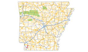
Arkansas Highway 134
Arkansas Highway 134 (AR 134, Hwy. 134) is an east–west state highway in Miller County, Arkansas. The route of 20.27 miles (32.62 km) runs from US Route 71 (US 71) near Fouke to US 82 in Garland.[2]
| ||||
|---|---|---|---|---|
 | ||||
| Route information | ||||
| Maintained by ArDOT | ||||
| Length | 20.27 mi[1] (32.62 km) | |||
| Major junctions | ||||
| West end | ||||
| East end | ||||
| Location | ||||
| Counties | Miller | |||
| Highway system | ||||
| ||||

Route description
AR 134 begins near Fouke and runs east underneath Highway 549, but does not have a junction with the route. The route runs north near the Red River and runs to Highway 196. Highway 134 turns east and runs to Garland, when it terminates at US 82.
Former Choctaw route
| |
|---|---|
| Location | Choctaw |
| Existed | c. 1928–c. 1931 |
This route first appeared on the October 1928 state highway map from Highway 9 to Choctaw; the current Highway 134 also first appeared at this time.[3] This road remained on the map through July 1931, but was removed on the following map.[4]
Major intersections
The entire route is in Miller County.
| Location | mi[1] | km | Destinations | Notes | |
|---|---|---|---|---|---|
| | 0.00 | 0.00 | Western terminus | ||
| | 16.43 | 26.44 | |||
| Garland | 20.27 | 32.62 | Eastern terminus | ||
| 1.000 mi = 1.609 km; 1.000 km = 0.621 mi | |||||
See also
References
- Planning and Research Division (2010). "Arkansas Road Log Database". Arkansas State Highway and Transportation Department. Archived from the original (Database) on 23 June 2011. Retrieved June 9, 2011.
- General Highway Map, Miller County, Arkansas (PDF) (Map). 1:62500. Cartography by Planning and Research Division. Arkansas State Highway and Transportation Department. 2010. Retrieved January 1, 2012.
- Arkansas State Highway Department (October 1, 1928). State of Arkansas Showing System of State Highways (TIF) (Map). Scale not given. Little Rock: Arkansas State Highway Commission. Retrieved April 26, 2020 – via Arkansas GIS Office.
- Arkansas State Highway Commission (June 1, 1931). Official Highway Service Map (TIF) (Revised). Scale not given. Little Rock: Arkansas State Highway Commission. Retrieved April 26, 2020 – via Arkansas GIS Office.
External links
![]()