Arkansas Highway 117
Arkansas Highway 117 (AR 117, Hwy. 117) is a north–south state highway in Lawrence County, Arkansas. The route of 16.54 miles (26.62 km) runs from a junction of Highway 25 and Highway 230 in Strawberry north across US Route 63/US 412 (US 63/US 412) to 3rd Street in Black Rock.[2]
| ||||
|---|---|---|---|---|
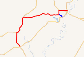
AR 117 in red (including concurrencies), AR 117S in blue | ||||
| Route information | ||||
| Maintained by ArDOT | ||||
| Length | 16.54 mi[1] (26.62 km) | |||
| Major junctions | ||||
| South end | ||||
| ||||
| North end | ||||
| Location | ||||
| Counties | Lawrence | |||
| Highway system | ||||
| ||||

Route description
The route begins at a junction of Highway 25/Highway 230 in Strawberry and runs north. Highway 117 forms a concurrency with Highway 115 at Jesop until Smithville. The routes pass the National Register of Historic Places-listed Smithville Public School Building before Highway 115 turns north with Highway 117 continuing east. After passing through Denton the route intersects Highway 117S toward Powhatan. The highway curves north to intersect US 63/US 412 in Black Rock, forming a concurrency east.[3]
Major intersections
Mile markers reset at concurrencies. The entire route is in Lawrence County.
| Location | mi[1] | km | Destinations | Notes | |
|---|---|---|---|---|---|
| Strawberry | 0.00 | 0.00 | Southern terminus | ||
| Jesup | 4.21 | 6.78 | |||
| Smithville | 0.00 | 0.00 | |||
| | 9.96 | 16.03 | |||
| Black Rock | 10.96 | 17.64 | |||
| 0.00 | 0.00 | ||||
| 1.11 | 1.79 | ||||
| 1.37 | 2.20 | Northern terminus | |||
| 1.000 mi = 1.609 km; 1.000 km = 0.621 mi | |||||
Powhatan spur
| |
|---|---|
| Location | Powhatan |
| Length | 1.26 mi[1] (2.03 km) |
Arkansas Highway 117 Spur (AR 117S, Hwy. 117S) is a 1.26-mile (2.03 km) spur route.[1] The route begins at Highway 117 and runs southeast to Powhatan.[2] Several properties on the National Register of Historic Places are contained in Powhatan and the adjacent Powhatan Courthouse State Park including the Powhatan Courthouse.
- Major intersections
The entire route is in Lawrence County.
| Location | mi[1] | km | Destinations | Notes | |
|---|---|---|---|---|---|
| | 0.00 | 0.00 | |||
| Powhatan | 1.26 | 2.03 | |||
| 1.000 mi = 1.609 km; 1.000 km = 0.621 mi | |||||
References
- Planning and Research Division (2010). "Arkansas Road Log Database". Arkansas State Highway and Transportation Department. Archived from the original (Database) on 23 June 2011. Retrieved June 9, 2011.
- General Highway Map, Lawrence County, Arkansas (PDF) (Map). 1:62500. Cartography by Planning and Research Division. Arkansas State Highway and Transportation Department. 2006. Retrieved October 16, 2011.
- Black Rock, Portia, and Powhatan, Lawrence County, Arkansas (PDF) (Map). Arkansas State Highway and Transportation Department. April 2009. Retrieved October 16, 2011.