Ardnadam
Ardnadam; (Scottish Gaelic: Àird nan Damh) is a village on the Holy Loch in the Cowal peninsula, Argyll and Bute, Scotland. northwest of Hunters Quay and east of Sandbank.[1][2]
Ardnadam
| |
|---|---|
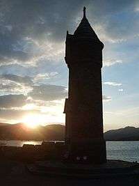 Sunset from Lazaretto Point | |
 Ardnadam Location within Argyll and Bute | |
| OS grid reference | NS17008000 |
| Council area | |
| Lieutenancy area | |
| Country | Scotland |
| Sovereign state | United Kingdom |
| Post town | DUNOON, ARGYLL |
| Postcode district | PA23 |
| Dialling code | 01369 |
| UK Parliament | |
| Scottish Parliament | |
Ardnadam Heritage Trail
Ardnadam Heritage Trail is 2.75 miles (4.43 km) long and climbs to Dunan Hill (Camels Hump), which has views across Loch Loskin, Dunoon, Holy Loch and the Firth of Clyde.[3]
Gallery
Ardnadam
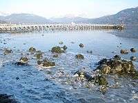 Ardnadam Pier Holy Loch - geograph.org.uk - 1750930
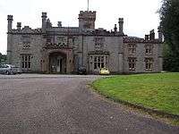 Hafton House by Ardnadam.
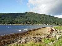 Ardnadam Bay - geograph.org.uk - 248535
References
- Ordnance Survey: Landranger map sheet 63 Firth of Clyde (Greenock & Rothesay) (Map). Ordnance Survey. 2014. ISBN 9780319229699.
- "Ordnance Survey: 1:50,000 Scale Gazetteer" (csv (download)). www.ordnancesurvey.co.uk. Ordnance Survey. 1 January 2016. Retrieved 30 January 2016.
- "Dunan - the Camel's Hump, Ardnadam". Walkhighlands. Retrieved 17 January 2017.
This article is issued from Wikipedia. The text is licensed under Creative Commons - Attribution - Sharealike. Additional terms may apply for the media files.