Arctic Cape
The Arctic Cape (Russian: Мыс Арктический, Mys Arkticheskiy) is a headland in Severnaya Zemlya, Russia.[1]
| Arctic Cape | |
|---|---|
| Мыс Арктический | |
 Location of Arctic Cape | |
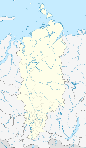 | |
| Location | Krasnoyarsk Krai, |
| Coordinates | 81°16′15.8″N 95°47′4.7″E |
| Offshore water bodies | Arctic Ocean |
| Area | Russian Far North |
With a distance of 990.7 km to the North Pole, the Arctic Cape is sometimes used as starting point for expeditions to the North Pole.
Geography
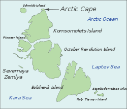
Stretching out towards the Arctic Ocean by the Molotov Glacier,[1] it is the northernmost point of Komsomolets Island,[2] which in turn is the northernmost island of the archipelago. Under Joseph Stalin the cape was known as Cape Molotov.[2]
The Arctic Cape is not the northernmost point of Russia. That distinction goes to Cape Fligely (mys Fligeli) on Rudolf Island (ostrov Rudolfa), an island in the Franz Josef Land archipelago. The northernmost point of mainland Asia is Cape Chelyuskin.
This cape also marks the Kara Sea's northeastern limit, which is the eastern end of a line running from Cape Kohlsaat in Franz Josef Land to the Arctic Cape.
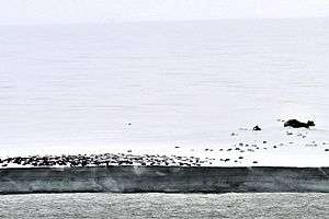 Empty oil drums at Arctic Cape |
References
- "Mys Arkticheskiy". Mapcarta. Retrieved 18 November 2016.
- Mills, William James (December 2003). Exploring Polar Frontiers: a Historical Encyclopedia. 2. ABC-CLIO. p. 668. ISBN 1-57607-422-6.
Ushakov and his two companions explored the west coast of the large central island—October Revolution—before crossing a strait to Komsomolets Island and sledging to the northernmost point of the archipelago. This is now known as Arctic Cape, though Ushakov originally named it for the later disgraced politician Vyechyslav Molotov.