Aravaipa Canyon Wilderness
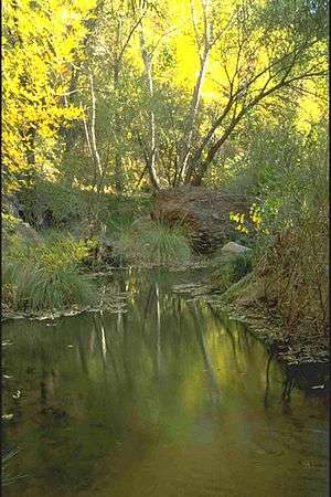
Aravaipa Canyon Wilderness is a 19,410 acres (7,850 ha) wilderness area located in the U.S. State of Arizona.
.jpg)
Aravaipa Canyon Wilderness, Arizona | |
|---|---|
 Aravaipa Canyon Wilderness Location within the state of Arizona | |
| Coordinates: 32.8970102°N 110.4875955°W[1] |
| Aravaipa Canyon Wilderness | |
|---|---|
IUCN category Ib (wilderness area) | |
 | |
| Location | Graham / Pinal counties, Arizona, U.S. |
| Nearest city | Globe, Arizona |
| Area | 19,700 acres (7,970 ha)[2] |
| Designated | 1984 |
| Governing body | Bureau of Land Management |
Access
The wilderness is administered by the BLM and is located northeast of Mammoth, Arizona in Graham and Pinal counties, about 120 miles (190 km) southeast of Phoenix. Pedestrian access to the preserve is allowed only with prior authorization from preserve staff. The area is popular for its recreation, especially its hiking trails and off-roading.[3][4] Visitors can hike to the abandoned cabin at the Parsons Grove site in the Aravaipa Canyon Preserve as of 2013.[5] Travel in the canyon requires wading in Aravaipa Creek.
Geography
The Aravaipa Canyon Wilderness forms the northwest border of the Galiuro Mountain range. The wilderness includes the 11-mile (18 km) long Aravaipa Canyon, the surrounding tablelands and nine side canyons. The Nature Conservancy's Aravaipa Canyon Preserve protects 7,000 acres (28 km2) of private land and is contiguous with the BLM wilderness area.
Permits and fees
A permit and fee are required to enter Aravaipa Canyon Wilderness. Use is limited to 50 people per day. Permits can be obtained from the BLM.
See also
- Galiuro Wilderness
- List of Arizona Wilderness Areas
- Native Fishes of Aravaipa Canyon
References
- "Aravaipa Canyon Wilderness". Geographic Names Information System. United States Geological Survey. Retrieved 2012-06-22.
- "Designated Wilderness Within The National Landscape Conservation System As Of September 30, 2011" (PDF). Bureau of Land Management.
- "Turkey Creek Trail". All Trails. 2019. Retrieved December 19, 2019.
- "Parsons Grove & Canyon via Rug Road, AZ". 2019. Retrieved December 19, 2019.
- "Rug Road Camping Trip Day 2, 6 April 2013". borntourist.com. Retrieved 2019-12-21.
Sources and external links
- BLM Aravaipa Canyon Wilderness page
- Nature Conservancy Aravaipa Canyon Preserve
- Wilderness.net Aravaipa Canyon Wilderness page
| Authority control |
|
|---|