Andersson Island
Andersson Island is a 7 mi (11 km) long and 4 mi (6.4 km) wide volcanic island of the James Ross Island Volcanic Group, located at the eastern end of the Tabarin Peninsula, Antarctica.[1]
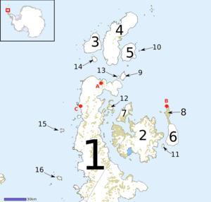 Andersson Island (labelled 9) amongst the island chain off the tip of the Antarctic Peninsula | |
 Andersson | |
| Geography | |
|---|---|
| Location | Antarctic Sound |
| Coordinates | 63°35′S 56°35′W |
| Archipelago | Joinville Island group |
| Adjacent bodies of water | Hope Bay |
| Length | 1.9 km (1.18 mi) |
| Highest elevation | 435 m (1,427 ft) |
| Administration | |
| Administered under the Antarctic Treaty System | |
The island was originally named Uruguay Island by the Swedish Antarctic Expedition, 1901-04, under Otto Nordenskjöld, after the Argentine ship Uruguay which participated in the rescue of the ship-wrecked Swedish Antarctic Expedition in 1903.[2] It was ultimately renamed Andersson Island on November 21, 1949. It was named for Dr. Johan Gunnar Andersson (1874-1960), a Swedish geologist who had served on the Swedish Antarctic Expedition. The renaming was necessary to avoid confusion with Uruguay Island, located off the Graham Coast.[3]
See also
- Cape Betbeder
- List of Antarctic and sub-Antarctic islands
- Yalour Sound
References
- "Geological Map of James Ross Island" (PDF). Retrieved 2020-03-23.
-


- Name Details
This article is issued from Wikipedia. The text is licensed under Creative Commons - Attribution - Sharealike. Additional terms may apply for the media files.