Ampney St Mary
Ampney St Mary is a small village and civil parish in the Cotswolds, part of the Cotswold of Gloucestershire, England.[1][2] According to the 2001 census the parish has a population of 54, increasing to 218 at the 2011 census.[3]
| Ampney St Mary | |
|---|---|
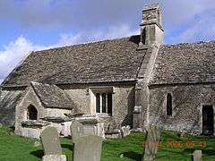 The church | |
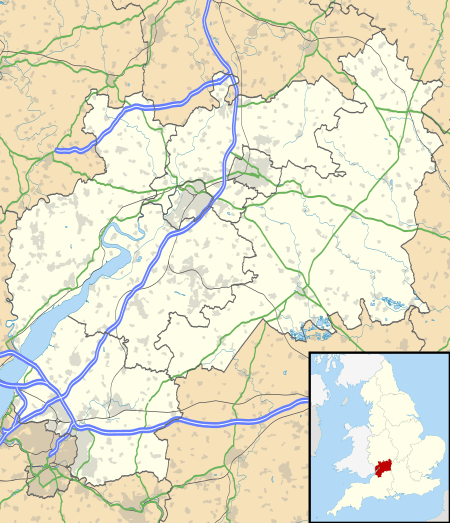 Ampney St Mary Location within Gloucestershire | |
| Population | 218 |
| OS grid reference | SP0802 |
| Shire county | |
| Region | |
| Country | England |
| Sovereign state | United Kingdom |
| Post town | Cirencester |
| Postcode district | GL7 |
| Police | Gloucestershire |
| Fire | Gloucestershire |
| Ambulance | South Western |
| UK Parliament | |
Ampney was listed in the Domesday Book of 1086.[4]
The Ampney Brook flows near the village, which is near to Ampney Crucis and Ampney St Peter, and is about four miles east of Cirencester. The village takes its name from the brook and the local church. The village is also locally known as "Ashbrook".
The village has an 18th-century public house, the Red Lion, one of the few public houses left without a bar counter, though it is now closed.
The Church of St Mary was built in the 12th and 13th centuries. It is a grade I listed building.[5]
References
- Ordnance Survey: Landranger map sheet 163 Cheltenham & Cirencester (Stow-on-the-Wold) (Map). Ordnance Survey. 2012. ISBN 9780319229125.
- "Ordnance Survey: 1:50,000 Scale Gazetteer" (csv (download)). www.ordnancesurvey.co.uk. Ordnance Survey. 1 January 2016. Retrieved 30 January 2016.
- "Parish population 2011". Retrieved 21 March 2015.
- Professor J.J.N.Palmer. "Open Doomsday: Ampney [St Mary]". www.opendomesday.org. Anna Powell-Smith. Retrieved 31 January 2016.
- "Church of St Mary". National Heritage List for England. Historic England. Retrieved 24 October 2019.
External links

- Ampney [St Mary] in the Domesday Book