Alore
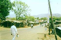
Alore is a village in the Chiplun taluka of Ratnagiri district, Maharashtra, India.[1] It lies on a bypass of the state highway linking the nearest town of Chiplun to Karad, and is located about 12.0 km (7.5 mi) east of the nearest town, that is Chiplun.
Alore | |
|---|---|
village | |
 | |
 Alore Location in Maharashtra, India  Alore Alore (India) | |
| Coordinates: 17.47°N 73.62°E | |
| Country | |
| State | Maharashtra |
| District | Ratnagiri |
| Elevation | 73.2 m (240.2 ft) |
| Population (2014) | |
| • Total | 3,573 |
| Languages | |
| • Official | Marathi |
| Time zone | UTC+5:30 (IST) |
| PIN | 415 603 |
| Telephone code | 02355 |
| Vehicle registration | MH-08 |
Alore Pin code is 415603 and postal head office is Alore .
Kolkewadi ( 2 KM ) , Pedhambe ( 3 KM ) , Adare ( 6 KM ) , Gane ( 6 KM ) , Kanhe ( 7 KM ) are the nearby Villages to Alore. Alore is surrounded by Khed Taluka towards North , Patan Taluka towards East , Sangmeshwar Taluka towards South , Guhagar Taluka towards west .
Chiplun , Satara , Mahabaleswar , Karad are the near by Cities to Alore.
Language
Marathi is the most common language spoken here.
See also
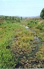
A tributary of the Vashishti River near Alore
This article is issued from Wikipedia. The text is licensed under Creative Commons - Attribution - Sharealike. Additional terms may apply for the media files.